Mount Binaiya — Mount Binaiya … Wikipedia
Seram — Gewässer Pazifischer Ozean Inselgruppe Molukken … Deutsch Wikipedia
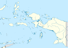
Seram Island — For the village in Nepal, see Seram, Nepal. Seram Island Geography Location South East … Wikipedia
List of mountains — Eight thousanders The 14 eight thousanders , 8,000 meters or higher above sea level, all in the Himalayas: *Everest (8,848 m), Nepal Tibet (China), Asia *K2 (8,611 m), Pakistan Xinjiang (China), Asia *Kangchenjunga (8,586 m), Nepal Sikkim (India) … Wikipedia
Maluku Islands — Maluku redirects here. For the Indonesian provinces encompassing the islands, see Maluku (province) and North Maluku. Maluku Island within Indonesia yellow : North Maluku province red : Maluku province … Wikipedia
Seram — Infobox Islands name = Seram Island image caption = locator native name = native name link = location = South East Asia coordinates= archipelago = Molucca Islands total islands = major islands = area = 17,100 km² (6,600 mi²) rank = 52nd highest… … Wikipedia
Pelni list of ships — Pelni ( Pelayaran Nasional Indonesia ) is the national shipping company of Indonesia. It operates twenty eight ships; twenty five of these are passenger ships that serve a variety of routes within the archipelago, mostly on a bi weekly or monthly … Wikipedia
Tatamailau — pd3pd5 Tatamailau Der Tatamailau, der höchste Berg Timors Höhe 2.963 m … Deutsch Wikipedia
Archipel des Moluques — Moluques Moluques Maluku (id) Carte des Moluques. Géographie Pays … Wikipédia en Français
Les Moluques — Moluques Moluques Maluku (id) Carte des Moluques. Géographie Pays … Wikipédia en Français