- Bojanow
-
Bojanow
Bojanów
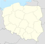
Basisdaten Staat: Polen Woiwodschaft: Schlesien Landkreis: Racibórz Gmina: Kranowitz Geographische Lage: 50° 2′ N, 18° 10′ O50.03027777777818.162777777778Koordinaten: 50° 1′ 49″ N, 18° 9′ 46″ O Einwohner: 800 ([1])
Postleitzahl: 47-470 Telefonvorwahl: (+48) 32 Kfz-Kennzeichen: SRC Wirtschaft und Verkehr Nächster int. Flughafen: Kattowitz Bojanow, Polnisch Bojanów, ist ein Dorf in der Stadt- und Landgemeinde Kranowitz im Powiat Raciborski in der Woiwodschaft Schlesien, Polen.
Inhaltsverzeichnis
Geografie
Bojanow liegt 2,5 Kilometer nordöstlich von Kranowitz und 7 Kilometer südwestlich von Racibórz (Ratibor) an der Zinna in der Region Oberschlesien, nahe der Grenze zu Tschechien, die rund 4 km südlich verläuft.
Geschichte
Die erste urkundliche Erwähnung des Ortsnamens stammt aus einem Dokument des Jahres 1313, in dem ein Ritter Gerhard von Boianow[2] als Zeuge auftritt.[1] 1532 wurde der Ort als Bojanoff verzeichnet.[2]
Im Jahre 1358 vermachte Fürstin Eufemia von Ratibor das Dorf den Ratiborer Dominikanerinnen, die in Bojanow 1370 einen Konvent gründeten, und schenkte den Bauern einen Freibrief, der 50 Jahre später aber zinspflichtig wurde. Woinowitz ging in der Folgezeit in den Besitz verschiedener Adliger über, bis sich die Dorfbewohner im Jahre 1796 zusammen mit Woinowitz und Lekartow für 191.000 Taler loskauften. Am 5. Oktober 1797 wurde dies durch den dirigierenden Minister in Schlesien Karl Georg von Hoym bestätigt und am 12. Oktober der Eintrag in die Hypothek vollzogen.[1]
1742 fiel das Dorf an Preußen und wurde 1816 dem Landkreis Ratibor zugeteilt.
Bei der Volksabstimmung in Oberschlesien am 20. März 1921 stimmten in Bojanow 357 Personen (82,3%) für den Verbleib bei Deutschland und 77 für die Angliederung an Polen. Bojanow verblieb beim Deutschen Reich.[3]
Von 1928 bis 1929 wurde die Christkönigkirche auf Betreiben des Pfarrers und Dekans Franz Janta errichtet.
Ab 1933 führten die neuen nationalsozialistischen Machthaber groß angelegte Umbenennungen von Ortsnamen slawischen Ursprungs durch. 1936 wurde Bojanow in Kriegsbach umbenannt.
Nach dem Zweiten Weltkrieg kam das Dorf 1945 als Bojanów unter polnische Verwaltung.
Heute gehört Bojanow der Gemeinde Kranowitz an, die die Gemeinde mit der anteilsmäßig größten deutschen Minderheit in der Woiwodschaft Schlesien ist. Im Jahre 2008 wurden zusätzliche amtliche Ortsnamen in deutscher Sprache eingeführt.
Einwohnerentwicklung
Die Einwohnerzahlen Bojanows:[4]
Jahr Einwohner 1822 461 1830 497 1844 584 1855 486 1861 512 Jahr Einwohner 1885 618 1910 698 1933 920 1939 947 Weblinks
- Informationen über Bojanow (deutsch, polnisch)
Fußnoten
- ↑ a b c Vgl. Gemeindewebsite abger. am 25. Oktober 2009
- ↑ a b Vgl. Johann Georg Knie: Alphabetisch-statistisch-topographische Uebersicht der Dörfer, Flecken, Städte und andern Orte der Königl. Preuss. Provinz Schlesien. Breslau 1845
- ↑ Vgl. Ergebnisse der Volksabstimmung; abger. am 25. Oktober 2009
- ↑ Quellen der Einwohnerzahlen: 1822: [1] – 1830: [2] – 1844: [3] – 1855, 1861: [4] - 1910: [5] – 1885, 1933, 1939: [6]
Gemeinde KranowitzSchulzenämter: Bojanow | Borutin | Klein Peterwitz | Woinowitz
Wikimedia Foundation.
Schlagen Sie auch in anderen Wörterbüchern nach:
Bojanów — ist der Name mehrerer Orte in Polen polnischer Name einer zweisprachigen Ortschaft in der Gemeinde Kranowitz, Woiwodschaft Schlesien, siehe Bojanow Ortschaft in der Gemeinde Skomlin, Woiwodschaft Łódź, siehe Bojanów (Skomlin) Hauptort der… … Deutsch Wikipedia
Bojanów, Subcarpathian Voivodeship — Infobox Settlement name = Bojanów settlement type = Village total type = image caption = image shield = subdivision type = Country subdivision name = flag icon|Poland Poland subdivision type1 = Voivodeship subdivision name1 = Subcarpathian… … Wikipedia
Bojanów, Łódź Voivodeship — Infobox Settlement name = Bojanów settlement type = Village total type = image shield = subdivision type = Country subdivision name = POL subdivision type1 = Voivodeship subdivision name1 = Łódź subdivision type2 = County subdivision name2 =… … Wikipedia
Bojanow — Original name in latin Bojanw Name in other language Boyanuv State code PL Continent/City Europe/Warsaw longitude 50.42531 latitude 21.95111 altitude 176 Population 1200 Date 2012 10 01 … Cities with a population over 1000 database
Gmina Bojanów — Infobox Settlement name = Gmina Bojanów other name = Bojanów Commune settlement type = Gmina total type = Total image shield = subdivision type = Country subdivision name = POL subdivision type1 = Voivodeship subdivision name1 = Subcarpathian… … Wikipedia
Гмина Боянув — Gmina Bojanów Герб Файл:Bojanow.gif Страна: Польша Повят: Сталёвовольский повят Глава: Славомир Серафин (2006) Площадь: 179,6 км² Население: 7160 чел … Википедия
Cisów Las — Village Country Poland Voivodeship Subcarpathian … Wikipedia
Maziarnia, Stalowa Wola County — For other places with the same name, see Maziarnia. Maziarnia Village Country Poland Voivodes … Wikipedia
Burdze — Infobox Settlement name = Burdze settlement type = Village total type = image caption = image shield = subdivision type = Country subdivision name = flag icon|Poland Poland subdivision type1 = Voivodeship subdivision name1 = Subcarpathian… … Wikipedia
Korabina — Infobox Settlement name = Korabina settlement type = Village total type = image caption = image shield = subdivision type = Country subdivision name = flag icon|Poland Poland subdivision type1 = Voivodeship subdivision name1 = Subcarpathian… … Wikipedia

