California State Route 282
- California State Route 282
-
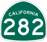
California State Route 282, kurz CA 282, ist ein Highway im US-Bundesstaat Kalifornien.
Der Highway beginnt an der California State Route 75 in Coronado und endet an der Naval Air Station North Island nach einem Kilometer.
Siehe auch
Weblinks
Wikimedia Foundation.
Schlagen Sie auch in anderen Wörterbüchern nach:
California State Route 282 — Infobox road state=CA type=SR route=282 section=582 maint=Caltrans length mi=0.6 length round=1 length ref= [ [http://www.dot.ca.gov/hq/structur/strmaint/brlog2.htm January 1, 2006 California Log of Bridges on State Highways] ] direction a=West… … Wikipedia
California State Route 75 — Karte … Deutsch Wikipedia
California State Route 149 — State Route 149 Route information … Wikipedia
California State Route 70 — Infobox road state=CA type=SR route=70 section=370 maint=Caltrans length mi=178.528 length ref= length round=3 length notes=(plus about 0.5 mi (1 km) on SR 20) history=State highway in 1910 and 1931; became SR 24 in 1934, US 40A in 1954, and SR… … Wikipedia
California State Route 283 — Infobox road state=CA type=SR route=283 section=583 maint=Caltrans length mi=0.36 length ref= [ [http://www.dot.ca.gov/hq/structur/strmaint/brlog2.htm January 1, 2006 California Log of Bridges on State Highways] ] length round=2 established=1970… … Wikipedia
California State Route 75 — Infobox road state=CA type=SR route=75 section=375 maint=Caltrans length mi=13 length round=0 length ref= [http://www.dot.ca.gov/hq/structur/strmaint/brlog2.htm January 1, 2006 California Log of Bridges on State Highways] ] direction a=South… … Wikipedia
California State Route 281 — Infobox road state=CA type=SR route=281 section=581 maint=Caltrans length mi=17 length round=0 length ref= [ [http://www.dot.ca.gov/hq/structur/strmaint/brlog2.htm January 1, 2006 California Log of Bridges on State Highways] ] direction a=West… … Wikipedia
Nevada State Route 512 — State Route 512 Kings Canyon Road, King Street; Division Street, W. Fifth Street Route information Length: 2.282 mi … Wikipedia
California Freeway and Expressway System — The California Freeway and Expressway System is a system of existing or planned freeways and expressways in the U.S. state of California. It is defined by the Streets and Highways Code.List of roads in the system*State Route 1 (part) *State Route … Wikipedia
California's 1st congressional district — This page is about California s 1st congressional district. You may be looking for California State Route 1. Infobox U.S. congressional district state = California district number = 1 representative = Mike Thompson party = Democratic english area … Wikipedia
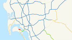
 CA 75 in Coronado
