California State Route 266
- California State Route 266
-
Wikimedia Foundation.
Schlagen Sie auch in anderen Wörterbüchern nach:
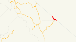
California State Route 266 — Infobox road state=CA type=SR route=266 section=566 maint=Caltrans length mi=11.721 length round=3 length ref= direction a=South terminus a=Jct|state=NV|SR|266 towards Beatty, NV junction=Jct|state=CA|SR|168 at Oasis direction b=North terminus… … Wikipedia
Nevada State Route 266 — State Route 266 Lida Road Route information Maintained by NDOT Length: 4 … Wikipedia
Nevada State Route 266 — Basisdaten Gesamtlänge: 40.3 mi/64.9 km Eröffnung: … Deutsch Wikipedia
California State Route 168 — Infobox road state=CA type=SR route=168 alternate name=Sierra Freeway, Tollhouse Road section=468 maint=Caltrans length mi=124 length round=2 length ref= [ [http://www.dot.ca.gov/hq/structur/strmaint/brlog2.htm January 1, 2006 California Log of… … Wikipedia
California State Route 139 — Infobox road state=CA type=SR route=139 section=439 maint=Caltrans length mi=121.836 length round=3 length ref= length notes=(plus about 21 mi (34 km) on SR 299) history=State highway in ca. 1940 and 1959; numbered by 1946 direction a=South… … Wikipedia
California State Route 19 — Infobox road state=CA type=SR route=19 section=319 and 464 maint=Caltrans alternate name=Lakewood Boulevard, Rosemead Boulevard length mi=26.2 length ref= [California Department of Transportation, [http://web.archive.org/web/20040306063946/http://… … Wikipedia
California State Route 88 — Infobox road state=CA type=SR route=88 section=388 maint=Caltrans length mi=122 length round=0 length ref= [ [http://www.dot.ca.gov/hq/structur/strmaint/brlog2.htm January 1, 2006 California Log of Bridges on State Highways] ] direction a=West… … Wikipedia
California State Route 28 — Infobox road state=CA type=SR route=28 section=328 maint=Caltrans length mi=11 length round=0 length ref= [ [http://www.dot.ca.gov/hq/structur/strmaint/brlog2.htm January 1, 2006 California Log of Bridges on State Highways] ] direction a=West… … Wikipedia
California State Route 267 — Infobox road state=CA type=SR route=267 section=567 maint=Caltrans length mi=12.69 length round=2 length ref= [ [http://www.dot.ca.gov/hq/structur/strmaint/brlog2.htm January 1, 2006 California Log of Bridges on State Highways] ] direction a=West … Wikipedia
California State Route 265 — Infobox road state=CA type=SR route=265 alternate name=Weed Boulevard section=565 maint=Caltrans length mi=0.54 length round=2 length ref= [ [http://www.dot.ca.gov/hq/structur/strmaint/brlog2.htm January 1, 2006 California Log of Bridges on State … Wikipedia
 NV 266
 NV 264 südlich von Dyer

 CA 168
