Cagles Mill Lake

Cagles Mill Lake
Cagles Mill Lake
Cagles Mill Lake IN.jpg
Zuflüsse: Mill Creek
Abflüsse: Mill Creek
Größere Orte in der Nähe: Cloverdale
Cagles Mill Lake (Indiana)
Cagles Mill Lake
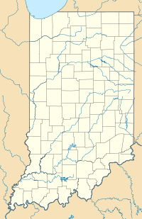
Koordinaten 39° 29′ 13″ N, 86° 54′ 58″ W39.486944444444-86.916111111111Koordinaten: 39° 29′ 13″ N, 86° 54′ 58″ W
Daten zum Bauwerk
Sperrentyp: Staudamm
Bauzeit: 1948 - 1952
Höhe des Absperrbauwerks: 45,7 m
Höhe der Bauwerkskrone: 222,5 m
Kronenlänge: 274 m
Basisbreite: 192 m
Betreiber: United States Army Corps of Engineers
Daten zum Stausee
Höhe des Stauziels: 194 m
Wasseroberfläche bei Vollstau: 5.7 km²dep1
Einzugsgebiet: 764 km²dep1

Der Cagles Mill Lake (auch Cataract Lake) ist ein Stausee am Mill Creek in Indiana und dient primär dem Hochwasserschutz. Der 1948 – 1952 vom United States Army Corps of Engineers errichtete Erd- und Steindamm befindet sich am Unterlauf des Flusses im Putnam County, etwa viereinhalb Kilometer vor Zusammenfluss des Mill Creeks mit dem Big Walnut Creek. Der größere Südostteil des Sees gehört zum Owen County.

Der See hat bei Normalstau - der Seespiegel liegt auf 193,9 m Seehöhe im Winter und auf 194,3 m im Sommer - eine Fläche von 5,7 km². Bei Hochwasser kann der Wasserspiegel um über 20 Meter steigen, durch die Überflutung angrenzender Täler hat der See dann eine mehr als dreimal so große Fläche. Eine nur etwa 100 m breite Engstelle, genannt „Middle Narrows“ teilt den Stausee in zwei Becken. Eine Brücke führt die Indiana State Road 42 über den schmalen Südteil des See. In deren Nähe liegt die einzige Insel des Gewässers, Ernie Pyle Island.

Benannt ist der See nach einer alten Mühle etwas unterhalb der Staumauer. Diese brannte 1975 ab, die Wehranlage ist noch erhalten. Der ebenfalls verwendete Name Cataract Lake leitet sich von den Cataract Falls ab, die sich nahe der Mündung des Mill Creeks in den See befinden.

Am Stausees befindet sich ein staatliches Erholungsgebiet, die Lieber State Recreation Area.

Weblinks


Wikimedia Foundation.

Игры ⚽ Поможем написать реферат

Schlagen Sie auch in anderen Wörterbüchern nach:

  • Cagles Mill Lake — Infobox lake lake name = Cagles Mill Lake image lake = Cagles Mill Lake IN.jpg caption lake = Cagles Mill Lake as seen from dam. U.S. Army Corps of Engineers photo. image bathymetry = caption bathymetry = location = Indiana coords =… …   Wikipedia

  • Mill Creek (Eel River, Indiana) — Mill Creek Eel River Mill Creek bei den Cataract FallsVorlage:Infobox Fluss/KARTE fehlt Daten …   Deutsch Wikipedia

  • Cataract Lake — ist der Name mehrerer Seen in den Vereinigten Staaten: Cataract Lake (Arizona) Cataract Lake (Colorado) Cataract Lake (Minnesota) Cataract Lake (Madison County, Montana) Cataract Lake (Stillwater County, Montana) Siehe auch: Cagles Mill Lake,… …   Deutsch Wikipedia

  • List of dams and reservoirs in the United States — This list is incomplete; you can help by expanding it. The following is a partial list of dams and reservoirs in the United States. There are an estimated 75,000 dams in the United States, impounding 600,000 mi (970,000 km) of river or about 17%… …   Wikipedia

  • Ernie Pyle Island — Vorlage:Infobox Insel/Wartung/Bild fehltVorlage:Infobox Insel/Wartung/Fläche fehltVorlage:Infobox Insel/Wartung/Höhe fehlt Ernie Pyle Island Gewässer Cagles Mill Lake Geographische Lage …   Deutsch Wikipedia

  • Indiana State Road 243 — Infobox road state=IN type=IN route=243 alternate name= length mi=5 length round= length ref= [http://illi indi.com/EndsPage.php?id=1243 section=1 Indiana Highway Ends SR 243] ] established= direction a=South starting terminus= junction=… …   Wikipedia

  • Eel River (Indiana) — Geobox River name = Eel River (Northern) native name = Kenapocomoco other name = L Anguille River other name1 = image size = 300 image caption = Collamer Dam country = United States country1 = state = Indiana region = region1 = district =… …   Wikipedia

  • Owen County (Indiana) — Owen County Courthouse in Spencer, gelistet im NRHP Nr. 94001351[1] Verwaltung …   Deutsch Wikipedia

  • Cataract Falls (Indiana) — Cataract Falls is located on the southern end of Cagles Mill Lake, near Cunot and Cataract, Indiana, just off Indiana State Road 42 and close to Indiana State Road 243 in the west central part of the state. Located in northern Owen County,… …   Wikipedia

  • Days Inn Cloverdale — (Cloverdale,США) Категория отеля: 2 звездочный отель Адрес: 1031 North Main Stre …   Каталог отелей

Share the article and excerpts

Direct link
Do a right-click on the link above
and select “Copy Link”