Cataract Covered Bridge

Cataract Covered Bridge
39.433444444444-86.813333333333

f1

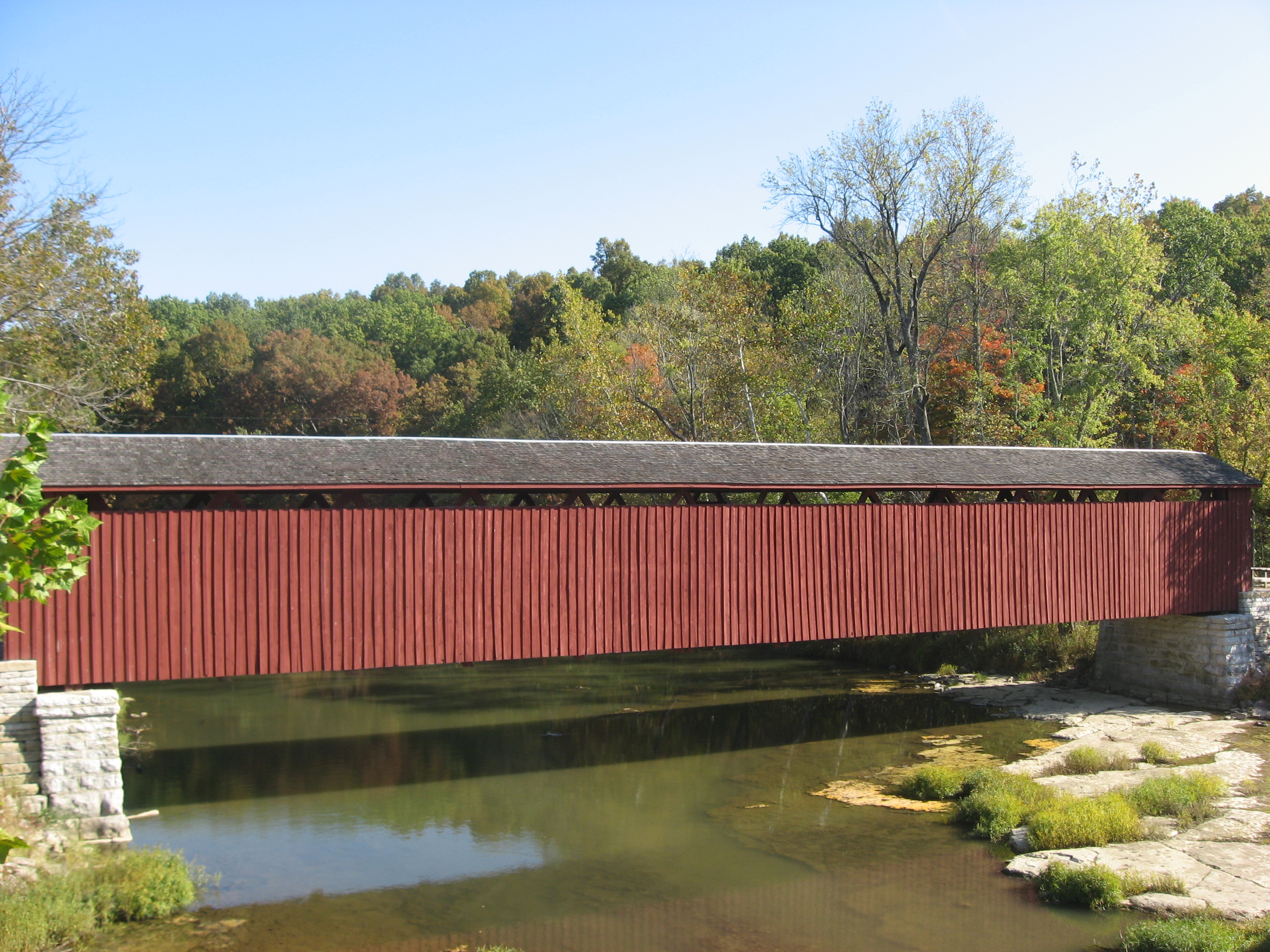
Cataract Covered Bridge
Cataract Covered Bridge im Jahr 2010
Nutzung nur Fußgänger
Querung von Mill Creek
Ort Jennings Township
Konstruktion gedeckte Fachwerkbrücke
Gesamtlänge 42,7 m
Anzahl der Öffnungen 1
Freigabe 1876

Die Cataract Covered Bridge ist eine gedeckte Holzbrücke im Owen County, Indiana. Sie überspannt den Mill Creek im Jennings Township oberhalb der Catarct Falls.

Notwendig wurde die Brücke, nachdem ein Hochwasser im August 1875 eine Vorgängerbrücke zerstörte. Die Cataract Covered Bridge wurde von der Smith Bridge Company aus Toledo errichtet. Sie ist etwa 140 ft (42,7 Meter) lang und war über 100 Jahre lang in Verwendung. Seit 1988 benutzen Fahrzeuge eine neue flussaufwärts befindliche Betonbrücke. 2004 erfolgte eine grundlegende Erneuerung.

Im Owen County ist die Cataract Covered Bridge die letzte ihrer Art. In Indiana gibt es noch sechs Brücken mit einem von Robert W. Smith patentierten Holzfachwerk. Die Brücke wurde 2005 ins National Register of Historic Places aufgenommen.

Weblinks


Wikimedia Foundation.

Игры ⚽ Нужно решить контрольную?

Schlagen Sie auch in anderen Wörterbüchern nach:

  • Covered bridge — The Cogan House Covered Bridge over Larrys Creek, Cogan House Township, Pennsylvania, U.S. Ancestor Truss bridge, others …   Wikipedia

  • Cataract Falls (Indiana) — Cataract Falls Koordinaten …   Deutsch Wikipedia

  • Rumbling Bridge — is a tiny village in Perth and Kinross, Scotland, nestling under the Ochil Hills, where the A823 leaves the A977, perched on the edge of the River Devon gorge. It is named after an unusual double bridge. The bridgeThe lower bridge, without… …   Wikipedia

  • National Register of Historic Places listings in Owen County, Indiana — Location of Owen County in Indiana This is a list of the National Register of Historic Places listings in Owen County, Indiana. This is intended to be a complete list of the properties and districts on the National Register of Historic Places in… …   Wikipedia

  • Mill Creek (Eel River, Indiana) — Mill Creek Eel River Mill Creek bei den Cataract FallsVorlage:Infobox Fluss/KARTE fehlt Daten …   Deutsch Wikipedia

  • Jennings Township (Owen County, Indiana) — Jennings Township Gemischtwarenladen in Cataract Jennings Township im Owen County …   Deutsch Wikipedia

  • Saint John River — Infobox River | river name = Saint John River caption = The course of the St. John River origin = Northwestern Maine mouth = Bay of Fundy at Saint John, NB basin countries = Canada, United States length = 673 km (418 mi) elevation = 360 m (1,181… …   Wikipedia

  • Victoria Falls — Location Livingstone, Zambia Victoria Falls, Zimbabwe Coordinates …   Wikipedia

  • literature — /lit euhr euh cheuhr, choor , li treuh /, n. 1. writings in which expression and form, in connection with ideas of permanent and universal interest, are characteristic or essential features, as poetry, novels, history, biography, and essays. 2.… …   Universalium

  • Timeline of Islamic science and engineering — This timeline of Islamic science and engineering covers the general development of science and technology in the Islamic world during the Islamic Golden Age, usually dated from the 7th to 16th centuries.From the 17th century onwards, the advances …   Wikipedia

Share the article and excerpts

Direct link
Do a right-click on the link above
and select “Copy Link”