- Circular Head Municipality
-
Circular Head 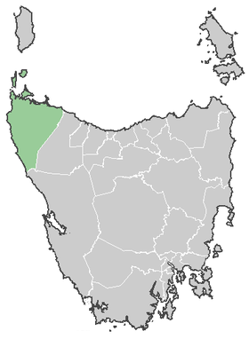
Lage von Circular Head in TasmanienGliederung Staat:  Australien
Bundesstaat:  Tasmanien
Verwaltungssitz: Smithton Daten und Zahlen Fläche: 4.917 km² Einwohner: 7.952 (2006) [1] Bevölkerungsdichte: 1,6 Einwohner je km² -40.833333333333145.11666666667Koordinaten: 40° 50′ S, 145° 7′ OCircular Head ist ein lokales Verwaltungsgebiet (LGA) im australischen Bundesstaat Tasmanien. Das Gebiet ist 4.917 km² groß und hat etwa 8.000 Einwohner.
Circular Head liegt an der Nordwestspitze der Insel etwa 300 km von der Hauptstadt Hobart entfernt. Das Gebiet umfasst 37 Ortsteile und Ortschaften: Alconde, Arthur River, Black River, Brittons, Broadmeadows, Christmas Hills, Cowrie Point, Crayfish Creek, Detention, Detention River, Edith Creek, Forest, Hellyer, Irishtown, Lileah, Marrawah, Mawbanna, Mella, Mengha, Montagu, Montagu Swamp, West Montagu, Nabageena, Port Latta, Redpa, Rocky Cape, Roger River, Scopus, Scothctown, Smithton, South Forest, Stanley, Swamp, Temma, Togari, Trowutta, Wiltshire und Woolnorth[2]. Der Sitz des Councils befindet sich in Smithton an der Küste im Norden der LGA, wo etwa 4200 Einwohner leben.[3]
Verwaltung
Der Circular Head Council hat neun Mitglieder. Der Mayor (Bürgermeister), sein Deputy (Stellvertreter) und sieben Councillor werden direkt von den Bewohnern der LGA gewählt. Circular Head ist nicht in Bezirke untergliedert.
Quellen
- ↑ Australian Bureau of Statistics (25. Oktober 2007): Circular Head (LGA) (Englisch). 2006 Census QuickStats. Abgerufen am 6. April 2010.
- ↑ Localities by Council, Local Government Association of Tasmania
- ↑ Australian Bureau of Statistics (25. Oktober 2007): Smithton (State Suburb) (Englisch). 2006 Census QuickStats. Abgerufen am 23. März 2010.
Weblinks

Wikimedia Foundation.