Canhestros

Canhestros
Canhestros
Wappen Karte
Wappen von Canhestros
Canhestros (Portugal)
Canhestros
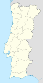
Basisdaten
Region: Alentejo
Unterregion: Baixo Alentejo
Distrikt: Beja
Concelho: Ferreira do Alentejo
Koordinaten: 38° 2′ N, 8° 17′ W38.03528-8.287094Koordinaten: 38° 2′ N, 8° 17′ W
Einwohner: 541 (Stand: 2001)
Fläche: 60,33 km²
Bevölkerungsdichte: 9 Einwohner pro km²

Vorlage:Infobox Ort in Portugal/Wartung/Art ist leer

Vorlage:Infobox Ort in Portugal/Wartung/Karte ist leer


Vorlage:Infobox Ort in Portugal/Wartung/Höhe ist leer Vorlage:Infobox Ort in Portugal/Wartung/PLZ ist leer Vorlage:Infobox Ort in Portugal/Wartung/Bürgermeister ist leer

Vorlage:Infobox Ort in Portugal/Wartung/Einwohnerstand ist leer

Vorlage:Infobox Ort in Portugal/Wartung/Verwaltungsort ist leer Vorlage:Infobox Ort in Portugal/Wartung/Webseite ist leer Vorlage:Infobox Ort in Portugal/Wartung/Email ist leer

Canhestros ist ein Ort und eine Gemeinde freguesia im Baixo Alentejo in Portugal. Der Ort liegt im Landkreise von Ferreira do Alentejo und hat eine Fläche von 60,33 km² mit 541 Einwohnern (2001). Dies ergibt eine Bevölkerungsdichte von nur 9,0 Einw./km².

Weblinks


Wikimedia Foundation.

Игры ⚽ Поможем сделать НИР

Schlagen Sie auch in anderen Wörterbüchern nach:

  • Canhestros — Saltar a navegación, búsqueda Canhestros Freguesia de Portugal …   Wikipedia Español

  • Casa do Avô — (Canhestros,Португалия) Категория отеля: Адрес: Rua da Casa do Povo, Canhestros, 7900 4 …   Каталог отелей

  • Феррейра-ду-Алентежу — порт. Ferreira do Alentejo Флаг Герб …   Википедия

  • Районы округа Бежа — …   Википедия

  • Каньештруш — Фрегезия Каньештруш порт. Canhestros Герб …   Википедия

  • List of postal codes in Portugal — Aveiro districtMealhada municipality*3050 Antes *3050 Barcouço *3050 Casal Comba *3050 Luso *3050 Mealhada *3050 Pampilhosa *3050 Vacariça *3050 Ventosa do BairroMurtosa municipality*3870 Bunheiro *3870 Monte *3870 Murtosa *3870 TorreiraOliveira… …   Wikipedia

  • Ferreira do Alentejo — Infobox Municipality pt official name = Ferreira do Alentejo image coat of arms = FAL.png District = Beja Mayor name = Aníbal Costa Mayor party = PS area total = 648.4 population total = 8,505 population density = 13 Parishes = 6 coor = 38º03 N… …   Wikipedia

  • Ferreira do Alentejo — Wappen Karte …   Deutsch Wikipedia

  • Ferreira Do Alentejo — Ferreira do Alentejo …   Wikipédia en Français

  • Ferreira do Alentejo — Géolocalisation sur la carte : Portugal …   Wikipédia en Français

Share the article and excerpts

Direct link
Do a right-click on the link above
and select “Copy Link”