- Cooplacurripa River
-
Cooplacurripa River 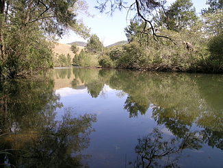
Cooplacurripa River
Daten Lage New South Wales, Australien Flusssystem Manning River Quelle bei Riamukka (Great Dividing Range) Quellhöhe 1.270 m[1] Mündung Nowendoc River beim Barakee-Nationalpark -31.4151.75148Koordinaten: 31° 24′ 0″ S, 151° 45′ 0″ O
31° 24′ 0″ S, 151° 45′ 0″ O-31.4151.75148Mündungshöhe 148 m[1] Höhenunterschied 1.122 m Länge 78,7[1] Linke Nebenflüsse Walcrow River, Mummel River Kleinstädte Cooplacurripa Der Cooplacurripa River ist ein Fluss im Osten des australischen Bundesstaates New South Wales.
Inhaltsverzeichnis
Geographie
Er entspringt im Nördlichen Tafelland von New South Wales auf einer Höhe von 1260 m auf der Great Dividing Range, ca. 3,5 km nordöstlich von Riamukka. Von dort fließt er nach Südosten, nimmt den Walcrow River und den Mummel River auf und mündet schließlich 33 km südöstlich von Nowendoc in den Nowendoc River.
Das Land entlang des Cooplacurripa River dient als Weidefläche, vornehmlich für die Haltung von Fleischkühen. Die 22560 ha große Kälberaufzuchtstation Cooplacurripa am Fluss gehörte früher der Australian Agricultural Company (AACo)[2] 1929 fand ein Mann in Cooplacurripa den Tod, als er den Fluss bei Flut überqueren wollte.[3]
Nebenflüsse[1] mit Mündungshöhen
- Walcrow River – 350 m
- Mummel River – 177 m
Verwaltung
Der Cooplacurripa River gehört zur Local Government Area Walcha und zum Hawes County.[4]
Fischfang
Die Liste der Forellengewässer in New South Wales weist den Cooplacurripa River und seine Nebenflüsse oberhalb des Zuflusses des Mummel River auf.[5]
Quelle
Einzelnachweise
- ↑ a b c d Map of Cooplacurripa River, NSW. Bonzle.com
- ↑ Cooplacurripa Sold for $ 16 Millions. ABC News
- ↑ Manning River: Four Record Floods: 1866 – 1929 – 1930 – 1978. Rod and Wendy Gow. Cundletown NSW
- ↑ Geographical Names Register Extract: Cooplacurripa River. Geographical Names Register (GNR) of NSW. Geographical Names Board of New South Wales
- ↑ Southern NSW Trout Waters. Artificial Fly and Lure only Waters. Trout and Salmon Fishing Rules. Fishing and Aquaculture. Department of Primary Industries. Government of New South Wales
Kategorien:- Flusssystem Manning River
- Fluss in New South Wales
- Fluss in Australien und Ozeanien

Wikimedia Foundation.