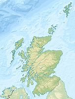
- Cuillin Hills
-
Cuillin Hills Höchster Gipfel Sgurr Alasdair (992 m ASL) Lage Schottland / Vereinigtes Königreich Teil der Insel Skye Koordinaten 57° 12′ N, 6° 12′ W57.2-6.2992Koordinaten: 57° 12′ N, 6° 12′ W Gestein Gabbro, Basalt, Granit Die Cuillin Hills (schottisch-gälisch: An Cuilthionn oder An Cuiltheann) sind eine felsige Gebirgslandschaft auf der schottischen Insel Skye, die zu den Inneren Hebriden gehört.
Sie setzen sich zusammen aus den Black Cuillins und den Red Cuillins (oder Red Hills). Zwischen diesen beiden Massiven erstreckt sich in Nord-Süd-Richtung das Glen Sligachan. Unter (The) Cuillin wird im engeren Sinne oftmals lediglich die Kette der Black Cuillins verstanden. Die Bezeichnung Red Cuillins besitzt – besonders auf Skye selbst – nur untergeordnete Bedeutung.
Die höchste Erhebung der Cuillin Hills ist der 992 m hohe Sgurr Alasdair in den Black Cuillins. Er ist damit gleichzeitig die höchste Erhebung der Insel Skye.
Inhaltsverzeichnis
Black Cuillins
Die Black Cuillins bestehen hauptsächlich aus Basalt und Gabbro. Die Namensgebung Black (dt. „schwarz“) Cuillin leitet sich von der dunklen Färbung des Gabbros ab. Der Kamm der Black Cuillins ist geprägt von zerklüftetem, nacktem Fels, steilen Klippen sowie tief eingeschnittenen Karen und Rinnen. Sämtliche zwölf Munros auf der Insel Skye liegen in den Black Cuillins. Davon stellt jedoch der Blaven (schottisch-gälisch: Bla Bheinn) einen Sonderfall dar: Er gehört zu einer Berggruppe, die wie die Red Cuillins durch das Glen Sligachan von der Hauptkette der Black Cuillins abgetrennt ist. Eine bekannte Wander- und Klettertour in den Black Cuillins ist die Querung der gesamten Gipfelkette (Black Cuillin (Ridge) Traverse).
Red Cuillins (The Red Hills)
Die Red Cuillins bzw. Red Hills (schottisch-gälisch: Am Binnean Dearg) bestehen vorwiegend aus Granit, der je nach Lichteinfall und Betrachtungswinkel im Gegensatz zum Dunkelgrau der Black Cuillins leicht rötlich erscheint. Die Formen der Berge sind durch Verwitterung stärker abgerundet als in den Black Cuillins, die Pflanzendecke reicht bis in Gipfelhöhe. Die Flanken werden von langen Geröllhalden dominiert.
Den höchsten Punkt der Red Cuillins bildet der Glamaig.
Bedeutende Gipfel
Folgende Liste enthält die Munros, Corbetts und Grahams der Cuillin Hills. Nicht in der Liste aufgeführt sind (Neben-)Gipfel wie der Clach Glas.
Gipfel Höhe (m) Schartenhöhe (m) Cuillin 1 Sgurr Alasdair 992 992 Black 2 Sgurr Dearg 986 182 Black 3 Sgurr a' Ghreadaidh 973 ca. 123 Black 4 Sgurr na Banachdich 965 ca. 114 Black 5 Sgurr nan Gillean 964 ca. 204 Black 6 Bruach na Frìthe 958 ca. 125 Black 7 Sgurr Mhic Choinnich 948 ca. 56 Black 8 Sgurr Dubh Mòr 944 ca. 89 Black 9 Am Basteir 934 ca. 55 Black 10 Bla Bheinn - Blaven 928 301 Blaven-Gruppe 11 Sgurr nan Eag 924 ca. 127 Black 12 Sgurr a' Mhadaidh 918 ca. 71 Black 13 Garbh-bheinn 808 172 Blaven-Gruppe 14 Glamaig 775 ca. 480 Red 15 Marsco 736 413 Red 16 Beinn Dearg Mhòr 731 152 Red 17 Belig 702 246 Blaven-Gruppe Landkarten
- Ordnance Survey: OS Outdoor Leisure 8 - The Cuillin & Torridon Hills, Maßstab 1:25000, Ordnance Survey, Southampton (Great Britain) 1995, ISBN 978-0319260081
- Ordnance Survey: OS Land Ranger Map 32 - South Skye & Cuillin Hills, Maßstab 1:50000, Ordnance Survey, Southampton (Great Britain) 2007, ISBN 978-0319229903
Weblinks
Wikimedia Foundation.


