Errochty Water

Errochty Water
Errochty Water
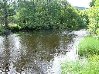
Errochty Water etwa in der Mitte des Flusslaufs

Errochty Water etwa in der Mitte des FlusslaufsVorlage:Infobox Fluss/KARTE_fehlt

DatenVorlage:Infobox Fluss/GKZ_fehlt
Lage Perth and Kinross, Schottland
Flusssystem Tay
Abfluss über Garry (Tummel) → Tummel → Tay → Firth of Tay → Nordsee
Flussgebietseinheit RBD Scotland
Quellsee Loch Errochty
56° 45′ 51″ N, 4° 6′ 21″ W56.7641-4.1058
Vorlage:Infobox Fluss/QUELLHÖHE_fehlt
Mündung bei Calvine in den Garry
56.765-3.949

56° 45′ 54″ N, 3° 56′ 56″ W56.765-3.949
Vorlage:Infobox Fluss/MÜNDUNGSHÖHE_fehltVorlage:Infobox Fluss/HÖHENUNTERSCHIED_fehlt
Länge 12 kmVorlage:Infobox Fluss/NACHWEISE_fehlenVorlage:Infobox Fluss/EINZUGSGEBIET_fehlt

Vorlage:Infobox Fluss/ABFLUSS_fehlt

Errochty Water ist ein Fluss im schottischen Hochland in der Unitary Authority Perth and Kinross.

Die Quelle des Errochty Water ist Loch Errochty. Der Fluss verlässt den See an dessen westlich gelegener Staumauer. Anschließend fließt Errochty Water weiter nach Westen, um nach circa 12 km bei Calvine in den Garry zu münden. Fast der gesamte Flusslauf liegt im Glen Errochty zwischen der B847 und dem Tay Forest Park.

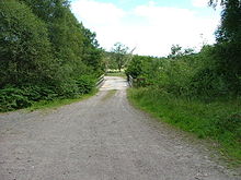
Brücke über Errochty Water

Wikimedia Foundation.

Игры ⚽ Нужен реферат?

Schlagen Sie auch in anderen Wörterbüchern nach:

  • Loch Errochty — Infobox lake lake name = Loch Errochty image lake = Loch Errochty, eastern end.jpg caption lake = The eastern end from Beinn a Chuallaich image bathymetry = caption bathymetry = location = Perth and Kinross, Scotland coords =… …   Wikipedia

  • Garry (Tummel) — Garry River Garry bei Blair AthollVorlage:Infobox Fluss/KARTE fehlt Da …   Deutsch Wikipedia

  • Clan Donnachaidh — / Clan Robertson Crest badge …   Wikipedia

  • Old military roads of Scotland — The remains of one of the military roads near the Corrieyairack Pass A network of military roads was constructed in the Scottish Highlands during the middle part of the 18th century as part of an attempt by the British Government to bring order… …   Wikipedia

  • Beinn a' Chuallaich — Infobox Mountain Name = Beinn a’ Chuallaich Photo = Beinn a Chuallaich from Schiehallion 8.jpg Caption = Seen across Dunalastair Water from Schiehallion, 7 km to the SE. Elevation = 892 m (2966 ft) Location = Perth and Kinross SCO Range =… …   Wikipedia

  • Tummel hydro-electric power scheme — The Tummel hydro electric power scheme for the generation of hydro electric power is located in the Grampian Mountains, between Loch Ericht, Loch Rannoch and Loch Tummel, in Perth and Kinross, Scotland. Strath Tummel is ideally suited to hydro… …   Wikipedia

  • Liste des lochs d'Écosse — Ce qui suit est une liste des lochs d Écosse. Cette liste est loin d être exhaustive: seuls les plus connus sont répertoriés. Il a été estimé qu il y a au moins 31 460 lacs d eau douce en Écosse, et plus de 7 500 dans les Hébrides extérieures… …   Wikipédia en Français

  • List of lochs in Scotland — The following is a list of lochs in Scotland. Loch is a Scottish Gaelic word for a lake or fiord, cognate with the Irish Gaelic lough , which has been borrowed by Scots and Scottish English to apply to such bodies of water, especially those… …   Wikipedia

  • Liste schottischer Lochs — Loch ist das schottisch gälische Wort für einen See oder eine Meeresbucht, einen Fjord (englisch Firth). Das Wort, lɔx, «loch» mit kehligem «ch» ausgesprochen, ist verwandt mit dem altirischen Lough, rekonstruierte indogermanische Wurzel… …   Deutsch Wikipedia

Share the article and excerpts

Direct link
Do a right-click on the link above
and select “Copy Link”