Forgandenny

Forgandenny
Forgandenny
Koordinaten 56° 21′ N, 3° 29′ W56.346944444444-3.4775Koordinaten: 56° 21′ N, 3° 29′ W
Forgandenny (Schottland)
Forgandenny
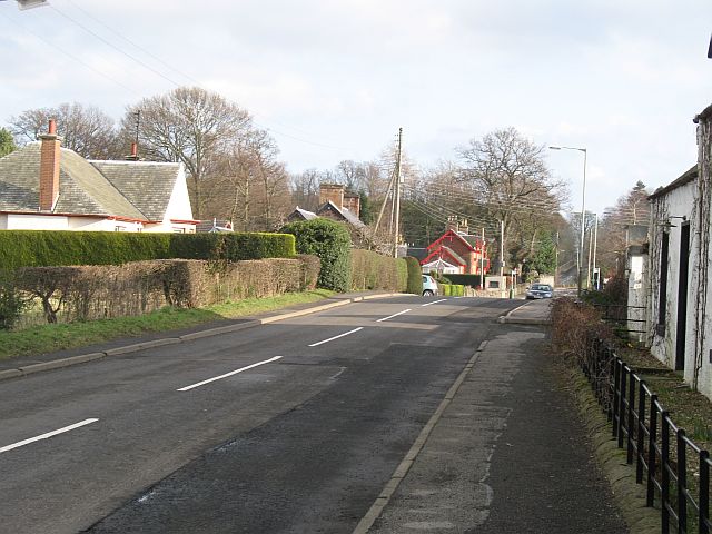
Forgandenny
Verwaltung
Post town PERTH
Postleitzahlen­abschnitt PH2
Vorwahl 01738
Landesteil Scotland
Unitary authority Perth and Kinross
Britisches Parlament Ochil and South Perthshire
Schottisches Parlament Perthshire South and Kinross
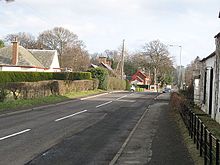
Hauptstraße von Forgandenny
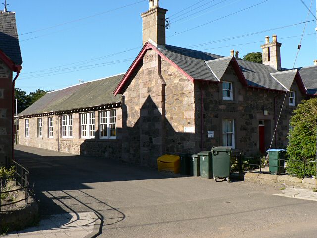
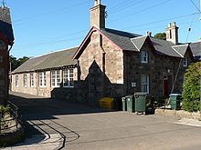
Schule von Forgandenny

Forgandenny (gälisch: Forgrann Eithne[1]) ist ein kleines Dorf in der schottischen Unitary Authority Perth and Kinross. Es liegt etwa 1,5 Kilometer südlich des Flusses Earn etwa 6 km südwestlich von Perth und 35 km nordöstlich von Stirling.[2]

Zwischen 1890 und 1928 wurde bei Forgandenny die überregional bedeutende Whiskybrennerei Stronachie betrieben.[3][4]

Verkehr

Etwa fünf Kilometer östlich der Ortschaft verläuft die M90, die Perth mit Edinburgh verbindet. Die A9 verläuft etwa vier Kilometer nordwestlich. Sie führt bis nach Thurso in Caithness im Norden Schottlands. Forgandenny selbst besitzt keinen Bahnhof. Der Bahnhof des nahegelegenen Perth ist jedoch Fernverkehrshalt.

Einzelnachweise

  1. Verzeichnis gälischer Ausdrücke
  2. Eintrag im Gazetteer for Scotland
  3. Informationen zur Stronachie-Brennerei bereitgestellt von der Royal Commission on the Ancient and Historical Monuments of Scotland
  4. Ulf Buxrud: Lost Scotch Malt Whisky Distilleries 1885-1945, 2001

Wikimedia Foundation.

Игры ⚽ Поможем сделать НИР

Schlagen Sie auch in anderen Wörterbüchern nach:

  • Forgandenny — is a small village in Perth and Kinross, located eight miles south west of Perth, Scotland, UK. Perth is a 20 minute bus ride from Forgandenny, and there is a regular Stagecoach service. Forgandenny is 45 minutes from Edinburgh and one hour from… …   Wikipedia

  • Forgandenny —    FORGANDENNY, a parish, partly in the county of Kinross, but chiefly in that of Perth, 3½ miles (W.) from Bridge of Earn; containing 796 inhabitants, of whom 66 are in the village. This parish is about ten miles in length, and two in average… …   A Topographical dictionary of Scotland

  • Forgandenny — Forgandenny, Marktflecken am Earn in der schott. Grafschaft Perth, Mineralquellen; 1000 Ew …   Pierer's Universal-Lexikon

  • Diocese of Dunkeld — Coordinates: 56°33′54″N 3°35′06″W / 56.565°N 3.585°W / 56.565; 3.585 This article is about historical …   Wikipedia

  • Perthshire — Motto: Pro Lege et Libertate ( For Law and Liberty ) Perthshire within Scotland Geography …   Wikipedia

  • Perth and Kinross — This article is about the Scottish local government area. For the former UK Parliamentary constituency abolished in 1997, see Perth and Kinross (UK Parliament constituency). Perth and Kinross Pairth an Kinross Peairt agus Ceann Rois Location …   Wikipedia

  • Strathallan School — Infobox Secondary school name = Strathallan motto = Labor omnia vincit established = 1913 type = Private coeducational boarding secondary grades = P6–S6, year 6 to year 13, 1J to Upper 6 city = Perth and Kinross country = Scotland campus = Rural; …   Wikipedia

  • Perthshire — Saltar a navegación, búsqueda Perthshire, Escocia Perthshire (Siorrachd Pheairt en gaélico), oficialmente el Condado de Perth, es un registro del condado en el centro de Escocia. Se extiende de Strathmore en el este, al paso de Drumochter en el… …   Wikipedia Español

  • Perth, Scotland — Coordinates: 56°23′49″N 3°26′14″W / 56.396911°N 3.437262°W / 56.396911; 3.437262 …   Wikipedia

  • Crieff — Coordinates: 56°22′32″N 3°50′33″W / 56.37568°N 3.84262°W / 56.37568; 3.84262 …   Wikipedia

Share the article and excerpts

Direct link
Do a right-click on the link above
and select “Copy Link”