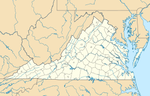
Grassy Ridge (Rockbridge County, Virginia)
Schlagen Sie auch in anderen Wörterbüchern nach:
Grassy Ridge — ist der Name zweier Gebirgskämmer in den Vereinigten Staaten: Grassy Ridge (Nelson County, Virginia), ein Gebirgskamm im Nelson County, im US Bundesstaat Virginia Grassy Ridge (Rockbridge County, Virginia), ein Gebirgskamm im Rockbridge County,… … Deutsch Wikipedia
Virginia — This article is about the U.S. state, the Commonwealth of Virginia. For other uses, see Virginia (disambiguation). Commonwealth of Virginia … Wikipedia
George Washington and Jefferson National Forests — Coordinates: 38°30′0″N 79°0′0″W / 38.5°N 79°W / 38.5; 79 … Wikipedia
Moore's Creek State Forest — is a 2,353 acre state forest in Rockbridge County, Virginia. Access to the trailhead is via US Forest Service road off State Route 612 in southwestern Rockbridge County. References Virginia State Forests website … Wikipedia
Mill Creek (Maury River) — Mill Creek Gewässerkennzahl US: 1485427 Lage Rockbridge County, Virginia, USA Flusssystem … Deutsch Wikipedia
Appalachian Trail by state — The Appalachian National Scenic Trail spans fourteen U.S. states during its journey that is 2,179 miles (3,507 km) long, including Georgia, North Carolina, Tennessee, Virginia, West Virginia, Maryland, Pennsylvania, New Jersey, New York,… … Wikipedia
Cuyahoga Valley National Park — IUCN Category II (National Park) Bedrock outcrops, such as this one, can be found throughout the park … Wikipedia

