Great Moss Swamp

Great Moss Swamp
Great Moss Swamp
Great Moss Swamp
Great Moss Swamp
Geographische Lage Region Otago, Südinsel (Neuseeland)
Abfluss Logan Burn zum Taieri River
Daten
Koordinaten 45° 32′ 53″ S, 169° 54′ 41″ O-45.5481189169.9113432Koordinaten: 45° 32′ 53″ S, 169° 54′ 41″ O
Great Moss Swamp (Neuseeland)
Great Moss Swamp

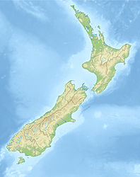
Der Great Moss Swamp (wörtlich: Großer Moos-Sumpf, auch Loganburn Reservoir) ist entgegen seines Namens heute kein Sumpf, sondern ein Stausee in der Region Otago auf der Südinsel Neuseelands.

Er liegt in der Maniototo Plain nahe der alten Goldgräberroute Dunstan Trail, 85 km nordwestlich von Dunedin. Nächstgelegene Orte sind die Siedlung Paerau etwa 15 km nördlich und Middlemarch etwa 20 km östlich, zu dem jedoch keine direkte Straßenverbindung besteht.

Der See liegt auf auf der Oberfläche der Rock and Pillar Range. Dieses Gebirge ist ein Horst und hat daher eine flache Oberfläche. Einst war der heutige See ein Sumpf, der jedoch durch einen Staudamm zur Bewässerung und Wasserkraftgewinnung überstaut wurde. Der See wird durch den Logan Burn entwässert, der bei Paerau in den Taieri River mündet.

Quelle


Wikimedia Foundation.

Игры ⚽ Нужно решить контрольную?

Schlagen Sie auch in anderen Wörterbüchern nach:

  • Great Moss Swamp — The Great Moss Swamp (also known as the Loganburn Reservoir) is located in Otago, New Zealand, at 45°33 S, 169°56 E. It lies in the Maniototo, close to the former gold mining route of the Old Dunstan Road, 85 kilometres to the northwest of… …   Wikipedia

  • Great Swamp — may mean:* United States: ** Great Swamp, New Jersey see Great Swamp National Wildlife Refuge and Glacial Lake Passaic until an article is created that features the entire swamp and its nature ** Great Swamp (New York) ** Great Swamp National… …   Wikipedia

  • Moss-forest Rat — Conservation status Least Concern (IUCN 2.3) Scientific classification Kingdo …   Wikipedia

  • German's One-toothed Moss Mouse — Scientific classification Kingdom: Animalia Phylum: Chordata Class …   Wikipedia

  • Paerau — is a small settlement in inland Otago in New Zealand s South Island. It is located in the upper valley of the Taieri River), at the foot of the Rock and Pillar Range. Its name means one hundred ridges in Maori.Despite being geographically close… …   Wikipedia

  • Paerau — p1 Paerau …   Deutsch Wikipedia

  • Rock and Pillar Range — The Rock and Pillar Range of high hills is located in the Maniototo, an area of inland Otago, New Zealand. They are surrounded by the Taieri River, which has its source in the range, flowing out across the scroll plain at Paerau, before almost… …   Wikipedia

  • Middle Atlantic coastal forests — Congaree National Park in South Carolina …   Wikipedia

  • railroad — /rayl rohd /, n. 1. a permanent road laid with rails, commonly in one or more pairs of continuous lines forming a track or tracks, on which locomotives and cars are run for the transportation of passengers, freight, and mail. 2. an entire system… …   Universalium

  • Outer Banks — North Carolina s Outer Banks separating the Atlantic Ocean (east) from Albemarle Sound (north) and Pamlico Sound (south). Orbital photo courtesy NASA. The Outer Banks (also known as OBX) is a 200 mile (320 km) long string of narrow barrier… …   Wikipedia

Share the article and excerpts

Direct link
Do a right-click on the link above
and select “Copy Link”