- Rock and Pillar Range
-
Rock and Pillar Range 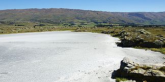
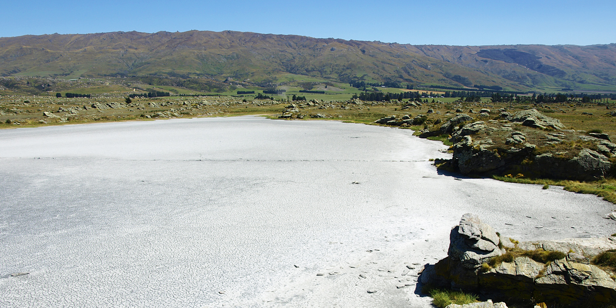
Der Sutton Salt Lake mit den Rock and Pillar Range im Hintergrund
Höchster Gipfel Summit Rock (1.450 m) Lage Central Otago, Neuseeland auf der Südinsel 

Koordinaten 45° 23′ S, 170° 7′ O-45.383333333333170.116666666671450Koordinaten: 45° 23′ S, 170° 7′ O Typ Bruchschollengebirge Als Rock and Pillar Range wird ein Bruchschollengebirge am östlichen Rand von Central Otago auf der Südinsel Neuseelands bezeichnet.
Inhaltsverzeichnis
Geografie
Die Rock and Pillar Range verlaufen, beidseitig vom Taieri River flankiert, in südwestlicher Richtung und gehen am südlichen Ende in die Lammermoor Range über. Die Entfernung zum Pazifischen Ozean beträgt 53 km. Die östliche Seite der Bergkette steigt moderat steil an und bekommt durch die Hyde-Verwerfung, welche direkt zwischen dem Taieri River und dem Fuß der Berge verläuft, Auftrieb. Dagegen fällt die westliche Seite sanft ab bis hinunter zum Oberlauf des Taieri River. Auf dem Kamm der Rock and Pillar Range erstreckt sich ein ungewöhnlich großes Plateau von 23 km Länge und 6 km Breite, welches an der höchsten Stelle 1.450 Meter misst.
Natur und Landschaft
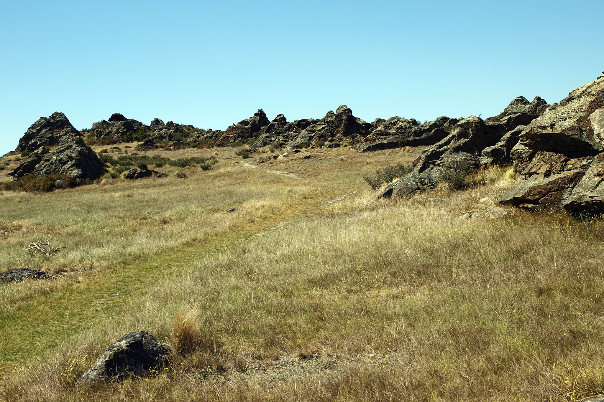
Gruppen von Felsen in Säulen- und Blockformen, sogenannte Tors (walisisch), kennzeichnen weite Teile der Bergkette. Schon aus der Entfernung kann man die aufragenden Felsen auf dem Gebirgskamm sehen. Bekannteste Formationen wurden hier als Stonehenge und Castle Rock bezeichnet.
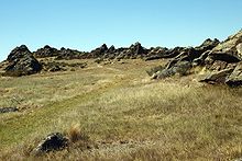 Felsenlandschaft mit Tussockgras
Die Vegetation ist typische, einer alpinen Landschaft verglichen. Die Kuppen der Berge sind lange mit Schnee bedeckt, der auch plötzlich im Sommer bei Temperaturstürzen noch auftreten kann. Vornehmlich wächst das widerstandsfähige Tussockgras. Reste von Wald mit Broadleaf[1] und Totara (Podocarpus totara) sind in den Taleinschnitten der Ostseite zu finden. In den höheren Regionen kommen robuste Kräuterpflanzen vor, wobei hier die Celmisia Viscosa, auch als Snow Mountain Daisy[2] bekannt, dominiert.
Nutzung
Die Rock and Pillar Range dient Wissenschaftlern der University of Otago seit mehr als 40 Jahren als Forschungsgebiet in den Disziplinen Botanik und Zoologie. Ein bereits dicht installiertes Messsystem und die Nähe zur Universität in Dunedin macht die Berglandschaft auch für Studierende zum einem beliebten Ziel für Exkursionen.
Quellen
alle Quellenangaben und Weblinks in englisch
- L. C. Bliss, A. F. Mark: High-Alpine Environments and Primary Production on the Rock and Pillar Range, Central Otago, New Zealand, New Zealand Journal of Botany 12, 1974.
- Recreation Plan - Public Access New Zealand, Dunedin (PDF-Datei; 14 kB)
Einzelnachweise
- ↑ Broadleaf - Te Ara - The Encyclopedia of New Zealand
- ↑ Celmisia Viscosa - New Zealand Plant Conservation Network
Weblinks
- Photos from a trip to the Rock and Pillar Range, held on 3rd April 2004 - Department of Botany, University of Otago

Wikimedia Foundation.