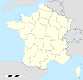
Guécélard

Guécélard
Guécélard
Guécélard (Frankreich)
Guécélard
Region Pays de la Loire
Département Sarthe
Arrondissement La Flèche
Kanton La Suze-sur-Sarthe
Gemeindeverband L’Orée de Bercé Bélinois.
Koordinaten 47° 53′ N, 0° 8′ O47.8761111111110.1275Koordinaten: 47° 53′ N, 0° 8′ O
Höhe 36–70 m
Fläche 12,18 km²
Einwohner 2.674 (1. Jan. 2008)
Bevölkerungsdichte 220 Einw./km²
Postleitzahl 72230
INSEE-Code
.

Guécélard ist eine Gemeinde mit 2674 Einwohnern (Stand 1. Januar 2008) im Kanton La Suze-sur-Sarthe in Frankreich. Sie liegt im Département Sarthe und in der Region Pays de la Loire. Ihre Einwohner heißen Guécélardais.

Inhaltsverzeichnis

Geografie

Guécélard liegt ca. 15 Kilometer südlich von Le Mans. In Guécélard mündet der Rhonne in die Sarthe, die die nordwestliche Gemeindegrenze bildet.

Bevölkerungsentwicklung

Die Einwohnerzahl von Guécélard ist von 1962 bis 2008 gestiegen – von 589 auf 2.674 Einwohner.

Infrastruktur

Guécélard liegt an der Fernstraße von Le Mans nach La Flèche. Ein Anschluss an die Autoroute A28 von Le Mans nach Tours besteht 15 Kilometer nordwestlich von Guécélard.

Weblinks


Wikimedia Foundation.

Игры ⚽ Нужна курсовая?

Schlagen Sie auch in anderen Wörterbüchern nach:

  • Guecelard — Guécélard Guécélard Administration Pays France Région Pays de la Loire Département Sarthe Arrondissement La Flèche Canton La Suze …   Wikipédia en Français

  • Guécélard — País …   Wikipedia Español

  • Guécélard — is a town and commune in the Sarthe département of France, in the Pays de la Loire région .ee also* Communes of the Sarthe department …   Wikipedia

  • Guécélard — 47° 52′ 34″ N 0° 07′ 39″ E / 47.8762, 0.1275 …   Wikipédia en Français

  • Guecelard — Original name in latin Guclard Name in other language Guecelard, Guclard State code FR Continent/City Europe/Paris longitude 47.87751 latitude 0.1293 altitude 40 Population 2734 Date 2012 01 18 …   Cities with a population over 1000 database

  • Rhonne — Photo souhaitée Merci Caractéristiques Longueur 24 9 km Bassin 77 km2 Bassin collecteur la Loire Débit moyen 0 197& …   Wikipédia en Français

  • Fillé — 47° 54′ 00″ N 0° 08′ 00″ E / 47.9, 0.1333333 …   Wikipédia en Français

  • Monce-en-Belin — Moncé en Belin Moncé en Belin Administration Pays France Région Pays de la Loire Département Sarthe Arrondissement Le Mans Canton …   Wikipédia en Français

  • Moncé-En-Belin — Administration Pays France Région Pays de la Loire Département Sarthe Arrondissement Le Mans Canton …   Wikipédia en Français

  • Moncé-en-Belin — 47° 53′ 43″ N 0° 11′ 56″ E / 47.895276, 0.19889 …   Wikipédia en Français

Share the article and excerpts

Direct link
Do a right-click on the link above
and select “Copy Link”