- Haigslea
-
Haigslea 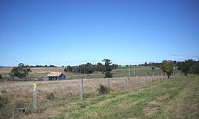
Staat:  Australien
Bundesstaat:  Queensland
Koordinaten: 27° 34′ S, 152° 38′ O-27.571528152.62985Koordinaten: 27° 34′ S, 152° 38′ O Einwohner: 422 (2006) [1] Zeitzone: AEST (UTC+10) LGA: Ipswich City 

Haigslea Haigslea ist heute ein Vorort von Ipswich in Queensland, Australien, der früher Kirchheim hieß. Am Ort führt der Warrego Highway vorbei. Im Jahr 2006 betrug die Einwohnerzahl 422.
Kirchheim wurde von deutschen Siedlern gegründet. In der antideutschen Stimmung während des Ersten Weltkriegs wurde der Ort umbenannt, so wie auch zahlreiche andere Orte mit deutschen Ortsnamen. Namensgebend war Douglas Haig (1861-1928), der als General der British Army von 1915 bis 1918 in Frankreich kämpfte.[2]
1913 trugen in Kirchheim 60% der Farmer deutsche Namen und die deutschen Siedlungen erstreckten sich von Marburg bis nach Walloon. 1874 hatte die Gemeinde eine lutherische Kirche errichtet, die bei einem Zyklon im Jahr 1924 zerstört und anschließend nicht mehr aufgebaut wurde.[3]
Im Ort befindet sich die Haigslea State School, die 1876 erbaut wurde und in der Nähe des Ortes liegt das Australian Motor Cycle Museum.
Weblinks
Einzelnachweise
- ↑ Australian Bureau of Statistics (25. Oktober 2007): Haigslea (Ipswich City) (Englisch). 2006 Census QuickStats. Abgerufen am 13. Februar 2011.
- ↑ Place name details
- ↑ Marburg, Haigslea und Ironbank auf queenslandplaces.com.au. Abgerufen am 15. Januar 2011
Kategorie:- Ort in Queensland


Wikimedia Foundation.