- Haines State Forest
-


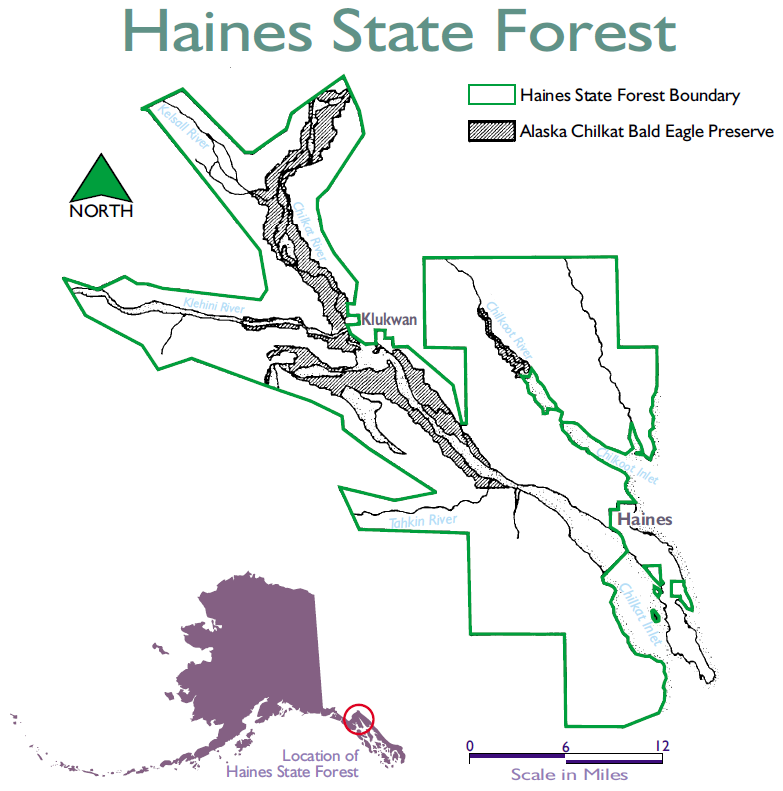
- Haines State Forest
- Alaska Chilkat Bald Eagle Preserve
Der 1982 gegründete Haines State Forest ist neben dem Tanana Valley State Forest einer von zwei Staatsforsten in Alaska.
Das 1157 km² große Waldgebiet im Nordwesten des Alaska Panhandle beinhaltet die Einzugsgebiete von Chilkoot River und Chilkat River mit dessen Zuflüssen Kelsall, Klehini und Tahkin River. Die Höhenstufen im State Forest reichen von Küstenregionen auf Meereshöhe bis zu Hochlagen mit über 2100 m in den Coast Mountains.
Die vorherrschenden Baumarten sind Sitka-Fichte, westliche Balsam-Pappel und Weide. Rund 15 % des Staatsforsts sind für den Holzabbau freigegeben.
Das Alaska Chilkat Bald Eagle Preserve liegt innerhalb des Staatsforsts.
Weblinks
59.226979-135.133272Koordinaten: 59° 13′ 37″ N, 135° 8′ 0″ WKategorien:- Waldgebiet in den Vereinigten Staaten
- Waldgebiet in Nordamerika
- Geographie (Alaska)
Wikimedia Foundation.