Illinois State Route 131

Illinois State Route 131
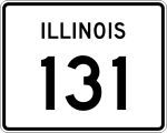
Straßenschild der Illinois State Route 131
Basisdaten
Gesamtlänge:  15,15 mi/24,38 km
Eröffnung:  1938
Anfangspunkt:  Illinois 176.svg IL 176 in Lake Bluff
Endpunkt:  WIS 31.svg WI 31 nahe Pleasant Prairie
County:  Lake County
Wichtige Stadt:  Waukegan

Die Illinois State Route 131 (kurz IL 131) ist eine State Route im US-Bundesstaat Illinois, die in Nord-Süd-Richtung verläuft.

Die State Route beginnt an der Illinois State Route 176 im Zentrum von Lake Bluff und endet nach 24 Kilometern nahe Pleasant Prairie an der Grenze zu Wisconsin. Nach der Grenze geht die Straße in die Wisconsin State Route 31 über.

Verlauf

Die IL 131 verlässt die Stadt Lake Bluff in nördlicher Richtung parallel zum U.S. Highway 41 im Westen und der Illinois State Route 137 im Osten. Westlich von North Chicago durchquert die State Route den Greenbett Forest. Im Anschluss passiert sie im Osten Waukegan und trifft in der Green Bay Road auf die State Route 132. Nördlich der Stadt verläuft die Straße am Waukegan Regional Airport entlang. Im Westen der Ortschaft Zion wird die State Route 173 gekreuzt, bevor die IL 131 nach insgesamt 24 Kilometern an der Grenze zu Wisconsin endet.

Siehe auch

Weblinks


Wikimedia Foundation.

Игры ⚽ Поможем сделать НИР

Schlagen Sie auch in anderen Wörterbüchern nach:

  • Illinois State Route 176 — Basisdaten Gesamtlänge:  41,28 mi/66,43 km Eröffnung:  …   Deutsch Wikipedia

  • Illinois State Route 132 — Basisdaten Gesamtlänge:  13,57 mi/21,84 km Eröffnung:  …   Deutsch Wikipedia

  • Illinois State Route 88 — Basisdaten Länge: 140 mi/226 km Bundesstaat: Illinois Verlaufsrichtung: Ost West …   Deutsch Wikipedia

  • Illinois Route 131 — Infobox Illinois state route article route = 131 length mi = 15.15 length round = 2 length ref = cite web |author=Illinois Technology Transfer Center |url=http://www.dot.state.il.us/gist2/select.html |title=T2 GIS Data |accessdate=2007 11 08… …   Wikipedia

  • Illinois Route 132 — Infobox Illinois state route article route = 132 length mi = 13.57 length km = 21.83 direction = East west starting terminus = ending terminus = counties = Lake cities = Lindenhurst, Gurnee, Lake Villa established = 1950Carlson, Rick. [http://www …   Wikipedia

  • Illinois Route 176 — Infobox Illinois state route article route = 176 length mi = 41.28 length round = 2 length ref = cite web |author=Illinois Technology Transfer Center |url=http://www.dot.state.il.us/gist2/select.html |title=T2 GIS Data |accessdate=2007 11 08… …   Wikipedia

  • Illinois Route 120 — Infobox Illinois state route article route = 120 length mi = 34.48 length round = 2 length ref = cite web |author=Illinois Technology Transfer Center |url=http://www.dot.state.il.us/gist2/select.html |title=T2 GIS Data |accessdate=2007 11 08… …   Wikipedia

  • Illinois Route 121 — Infobox Illinois state route article route = 121 length mi = 109.48 length round = 2 length ref = cite web |author=Illinois Technology Transfer Center |url=http://www.dot.state.il.us/gist2/select.html |title=T2 GIS Data |accessdate=2007 11 08… …   Wikipedia

  • Illinois Route 130 — Infobox Illinois state route article route = 130 length mi = 135.87 length round = 2 length ref = cite web |author=Illinois Technology Transfer Center |url=http://www.dot.state.il.us/gist2/select.html |title=T2 GIS Data |accessdate=2007 11 08… …   Wikipedia

  • Liste der State-, U.S.- und Interstate-Highways in Illinois — Dies ist eine Aufstellung von State Routes, U.S. Highways und Interstates im US Bundesstaat Illinois, nach Nummern. Inhaltsverzeichnis 1 State Routes 1.1 Gegenwärtige Strecken 1.2 Außer Dienst gestellte Strecken …   Deutsch Wikipedia

Share the article and excerpts

Direct link
Do a right-click on the link above
and select “Copy Link”