Illinois State Route 132

Illinois State Route 132
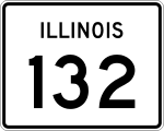
Straßenschild der Illinois State Route 132
Basisdaten
Gesamtlänge:  13,57 mi/21,84 km
Eröffnung:  1950
Anfangspunkt:  Illinois 59.svg IL 59 nahe Lake Villa
Endpunkt:  Illinois 131.svg IL 131 in Waukegan
County:  Lake County

Die Illinois State Route 132 (kurz IL 132) ist eine State Route im US-Bundesstaat Illinois, die in Ost-West-Richtung verläuft.

Die State Route beginnt an der Illinois State Route 59 nahe Lake Villa und endet nach 22 Kilometern in Waukegan an der Illinois State Route 131.

Verlauf

Nach der Abzweigung von der State Route 59 im Westen von Lake Villa am Fox Lake verläuft die IL 132 in östlicher Richtung und trifft im Zentrum der Stadt auf die Illinois State Route 83. Östlich von Lake Villa kreuzt sie den U.S. Highway 45 und im Westen von Gurnee passiert die Straße die Interstate 94, die in diesem Abschnitt den Tri-State Tollway bildet. Vor der Überquerung des Des Plaines Rivers trifft die IL 132 auf die Illinois State Route 21. Im Westen von Waukegan kreuzt die Straße den U.S. Highway 41, bevor sie nach 22 Kilometern an der Illinois State Route 131 endet.

Siehe auch

Weblinks


Wikimedia Foundation.

Игры ⚽ Нужно сделать НИР?

Schlagen Sie auch in anderen Wörterbüchern nach:

  • Illinois State Route 21 — Basisdaten Gesamtlänge:  28,13 mi/45,27 km Eröffnung:  …   Deutsch Wikipedia

  • Illinois State Route 131 — Basisdaten Gesamtlänge:  15,15 mi/24,38 km Eröffnung:  …   Deutsch Wikipedia

  • Illinois Route 132 — Infobox Illinois state route article route = 132 length mi = 13.57 length km = 21.83 direction = East west starting terminus = ending terminus = counties = Lake cities = Lindenhurst, Gurnee, Lake Villa established = 1950Carlson, Rick. [http://www …   Wikipedia

  • Illinois Route 131 — Infobox Illinois state route article route = 131 length mi = 15.15 length round = 2 length ref = cite web |author=Illinois Technology Transfer Center |url=http://www.dot.state.il.us/gist2/select.html |title=T2 GIS Data |accessdate=2007 11 08… …   Wikipedia

  • Illinois Route 121 — Infobox Illinois state route article route = 121 length mi = 109.48 length round = 2 length ref = cite web |author=Illinois Technology Transfer Center |url=http://www.dot.state.il.us/gist2/select.html |title=T2 GIS Data |accessdate=2007 11 08… …   Wikipedia

  • Illinois Route 133 — Infobox Illinois state route article route = 133 length mi = 52.05 length round = 2 length ref = cite web |author=Illinois Technology Transfer Center |url=http://www.dot.state.il.us/gist2/select.html |title=T2 GIS Data |accessdate=2007 11 08… …   Wikipedia

  • Liste der State-, U.S.- und Interstate-Highways in Illinois — Dies ist eine Aufstellung von State Routes, U.S. Highways und Interstates im US Bundesstaat Illinois, nach Nummern. Inhaltsverzeichnis 1 State Routes 1.1 Gegenwärtige Strecken 1.2 Außer Dienst gestellte Strecken …   Deutsch Wikipedia

  • Warren Township, Lake County, Illinois — Infobox Settlement official name = Warren Township settlement type = Township nickname = motto = imagesize = image caption = image imagesize = image caption = image mapsize = map caption = Location in Lake County mapsize1 = map caption1 =… …   Wikipedia

  • Grant Township, Lake County, Illinois — Infobox Settlement official name = Grant Township settlement type = Township nickname = motto = imagesize = image caption = image imagesize = image caption = image mapsize = map caption = Location in Lake County mapsize1 = map caption1 =… …   Wikipedia

  • Waukegan Township, Lake County, Illinois — Infobox Settlement official name = Waukegan Township settlement type = Township nickname = motto = imagesize = image caption = image imagesize = image caption = image mapsize = map caption = Location in Lake County mapsize1 = map caption1 =… …   Wikipedia

Share the article and excerpts

Direct link
Do a right-click on the link above
and select “Copy Link”