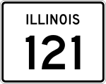
Illinois State Route 121

Illinois State Route 121
Straßenschild der Illinois State Route 121
Basisdaten
Gesamtlänge:  109,48 mi/176,19 km
Eröffnung:  1924
Anfangspunkt:  Illinois 130.svg IL 130 in Greenup
Endpunkt:  Straßenschild der I-55 I-55 Illinois 10.svg IL 10 in Lincoln
Countys:  Cumberland County
Coles County
Moultrie County
Macon County
Logan County
Wichtige Städte:  Toledo
Mattoon
Sullivan
Decatur

Die Illinois State Route 121 (kurz IL 121) ist eine State Route im US-Bundesstaat Illinois, die in Nord-Süd-Richtung verläuft.

Die State Route beginnt an der Illinois State Route 130 in Greenup und endet nach 176 Kilometern in Lincoln an der Interstate 55 und an der Illinois State Route 10.

Verlauf

Ab Greenup verläuft die State Route 121 zunächst in westlicher Richtung und trifft an der Ortsgrenze auf die Interstate 70. Ab der Montrose Road führt sie in nördliche Richtung. Gemeinsam mit dem U.S. Highway 45 kreuzt sie südlich von Mattoon die Interstate 57. Im Zentrum der Stadt trifft sie auf die State Route 16 und im Norden trennt sie sich wieder vom US 45. Die IL 121 verlässt Mattoon in nordwestlicher Richtung. In Sullivan nutzt sie für einige Kilometer die Trasse der Illinois State Route 32. In Dalton City zweigt die Illinois State Route 128 in südlicher Richtung ab.

Gemeinsam mit dem U.S. Highway 36 erreicht die IL 121 das Stadtgebiet von Decatur und überqueren den Lake Decatur. An der Kreuzung mit der State Route 105 trennt sie sich wieder vom US 36 und führt mit der Illinois State Route 48 gemeinsam auf der Pershing Road trifft dabei auf den U.S. Highway 51. Ab der Interstate 72 verlässt sie die Stadt in nordwestlicher Richtung. Im Osten von Mount Pulaski wird die IL 121 von der State Route 54 gekreuzt. Durch Lincoln verläuft sie gemeinsam mit der Illinois State Route 10 und endet westlich von Lincoln an der Interstate 55.

Siehe auch

Weblinks


Wikimedia Foundation.

Игры ⚽ Поможем написать курсовую

Schlagen Sie auch in anderen Wörterbüchern nach:

  • Illinois State Route 54 — Basisdaten Gesamtlänge:  104 mi/ 167 km Eröffnung:  …   Deutsch Wikipedia

  • Illinois State Route 105 — Basisdaten Gesamtlänge:  38 mi/60 km Eröffnung:  …   Deutsch Wikipedia

  • Illinois State Route 32 — Basisdaten Gesamtlänge:  69,32 mi/111,56 km Eröffnung:  …   Deutsch Wikipedia

  • Illinois State Route 10 — Basisdaten Gesamtlänge:  91,35 mi/147,01 km Eröffnung:  …   Deutsch Wikipedia

  • Illinois State Highway 54 — Basisdaten Gesamtlänge:  104 mi/ 167 km Eröffnung:  1972 Bundesstaat:  …   Deutsch Wikipedia

  • Illinois Route 121 — Infobox Illinois state route article route = 121 length mi = 109.48 length round = 2 length ref = cite web |author=Illinois Technology Transfer Center |url=http://www.dot.state.il.us/gist2/select.html |title=T2 GIS Data |accessdate=2007 11 08… …   Wikipedia

  • Illinois Route 137 — Infobox Illinois state route article route = 137 length mi = 23.49 length round = 2 length ref = cite web |author=Illinois Technology Transfer Center |url=http://www.dot.state.il.us/gist2/select.html |title=T2 GIS Data |accessdate=2007 11 08… …   Wikipedia

  • Illinois Route 132 — Infobox Illinois state route article route = 132 length mi = 13.57 length km = 21.83 direction = East west starting terminus = ending terminus = counties = Lake cities = Lindenhurst, Gurnee, Lake Villa established = 1950Carlson, Rick. [http://www …   Wikipedia

  • Illinois Route 131 — Infobox Illinois state route article route = 131 length mi = 15.15 length round = 2 length ref = cite web |author=Illinois Technology Transfer Center |url=http://www.dot.state.il.us/gist2/select.html |title=T2 GIS Data |accessdate=2007 11 08… …   Wikipedia

  • Illinois Route 116 — Infobox Illinois state route article route = 116 length mi = 176.07 length round = 2 length ref = cite web |author=Illinois Technology Transfer Center |url=http://www.dot.state.il.us/gist2/select.html |title=T2 GIS Data |accessdate=2007 11 08… …   Wikipedia

Share the article and excerpts

Direct link
Do a right-click on the link above
and select “Copy Link”