- Itang
-
8.234.266666666667Koordinaten: 8° 12′ N, 34° 16′ O
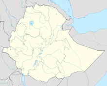

Itang Itang (auch Etang geschrieben,[1] Äthiopische Schrift: ኢታንግ[2]) ist eine Ortschaft in der Region Gambela im Westen Äthiopiens. Innerhalb Gambelas gehört sie zur gleichnamigen Woreda Itang, die in der Administrative Zone 1 liegt[2] oder – neueren Dokumenten der Zentralen Statistikagentur Äthiopiens zufolge – eine eigene Zone bildet.[1]
Bevölkerung
Nach Angaben der Zentralen Statistikagentur für 2005 hatte Itang 3.601 Einwohner.[2]
1994 waren von 2.106 Einwohnern 53,7 % Anuak, 28,54 % Nuer, 6,79 % Oromo, 6,41 % Amharen und 1,57 % Tigray; 3 % gehörten anderen ethnischen Gruppen an. 73,46 % waren Protestanten, 15,67 % Äthiopisch-Orthodoxe, 2,85 % Muslime, 2,23 % Anhänger traditioneller Religionen und 1,66 % Katholiken.[3]
Geschichte
Im anglo-äthiopischen Vertrag von 1902, der die Grenze zwischen Äthiopien und dem Sudan festlegte, stimmte Menelik II. der Errichtung einer britischen Handelsenklave im Gebiet von Itang zu. Großbritannien war als Kolonialmacht des Sudan daran interessiert, über den Nil-Nebenfluss Baro Handel mit Äthiopien zu treiben. Wahrscheinlich war Itangs zu große Entfernung vom äthiopischen Hochland der Hauptgrund dafür, dass Großbritannien 1904 das weiter flussaufwärts gelegene Gambela anstelle von Itang zum Handelsposten machte.[4]
In den 1980er Jahren kamen wegen des Bürgerkrieges im Südsudan zahlreiche sudanesische Flüchtlinge in die Region, und das Flüchtlingslager von Itang war zeitweise das größte der Welt.[5]
Im Juli 2002 brachen nach Streitigkeiten zwischen einem Anuak-Polizisten und einem Nuer-Lokalpolitiker Kämpfe zwischen den ethnischen Gruppen aus, wobei politische Konflikte um die Nachfolge des verstorbenen Nuer-Vizepräsidenten der Region Gambela eine wichtige Rolle spielten. Bei diesen Kämpfen, an denen sich Polizisten, Beamte, Studenten und Ortseinwohner beteiligten, wurden über 50 Menschen getötet und rund 500 Häuser im Anuak-Ortsteil verbrannt. Die sogenannte „Itang-Krise“ griff auch auf Gambela-Stadt und auf einige Flüchtlingslager über.[6]
Quellen
- ↑ a b Zentrale Statistikagentur (CSA): Summary and Statistical Report of the 2007 Population and Housing Census Results (PDF), S. 81
- ↑ a b c CSA: 2005 National Statistics, Section–B Population, Table B.4 (PDF)
- ↑ CSA: The 1994 Population and Housing Census of Ethiopia: Results for Gambella Region: Volume I Statistical Report (PDF), 1995 (S. 36, 51)
- ↑ Bahru Zewde: An Overview and Assessment of Gambella Trade (1904-1935), in: International Journal of African Historical Studies, Vol. 20/1, 1987, S. 75–94
- ↑ John Young: Along Ethiopia's Western Frontier: Gambella and Benishangul in Transition, in: The Journal of Modern African Studies, Vol. 37/2, Juni 1999 (S. 321–346)
- ↑ Chan Gatkuoth: Gambella Conflicts: The Role of the Government, in: Wolbert C. G. Smidt: Discussing conflict in Ethiopia. Conflict Management and Resolution: Proceedings of the Conference "Ethiopian and German Contributions to Conflict Management and Resolution", Addis Ababa, 11 to 12 November 2005, Afrikanische Studien 32, 2007, ISBN 9783825897956 (S. 161)

Wikimedia Foundation.