Ceerigaabo — Infobox City official name = Ceerigaabo, Erigavo| pushpin image caption = mapsize = map caption = Location in Somalia subdivision type = Regions of Somalia subdivision name = Sanaag leader title = leader name = Jibrell Ali Salaad area note =… … Wikipedia
Ceerigaabo — Original name in latin Ceerigaabo Name in other language Ceerigaabo, Cerigaabo, ERA, Erigabo, Erigavo State code SO Continent/City Africa/Mogadishu longitude 10.61616 latitude 47.36795 altitude 1786 Population 33853 Date 2012 01 16 … Cities with a population over 1000 database
Ceerigaabo Airport — Erigavo Airport is an airport in Erigavo, Somalia airport codes|ERI|HCMU.References* [http://www.world airport codes.com/somalia/erigavo 2196.html Erigavo Airport (ERA) Details Somalia] … Wikipedia
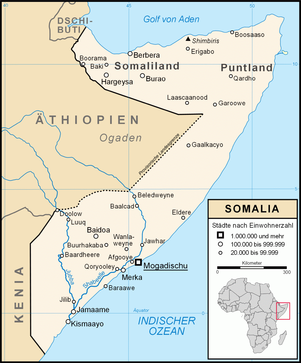
States and regions of Somalia — Five quasi independent macro regions have formed in Somalia since the 1990s. These entities and their capitals are:) ) ) ) )The regions of Somalia have been correspondingly changed by these entities. Somalia *Transitional Federal Government: **… … Wikipedia
Regions de Somalie — Régions de Somalie Carte de la Somalie … Wikipédia en Français
Régions de Somalie — Carte de la Somalie Carte de la Somalie indiquant le … Wikipédia en Français
Régions de somalie — Carte de la Somalie … Wikipédia en Français
Somaliland — For other uses, see Somaliland (disambiguation). Somaliland locally known as Jamhuuriyadda Soomaaliland جمهورية أرض الصومال Jumhūrīyat Ṣūmāliland Republic of Somaliland … Wikipedia
Административное деление Сомали — Сомали имеет международно признанное Переходное Федеральное Правительство. Бывшее Британское Сомали Сомалиленд объявило о своей независимости, как и ряд других непризнанных государственных образований. Ныне на территории Сомали с… … Википедия
Sanaag — (Somali: Sanaag ) is a region ( gobol ) in northern Somalia. Sanaag is claimed by the autonomous Somaliland, Puntland, and Maakhir macro regions of Somalia. It was the largest region of the former British Somaliland protectorate. Its capital city … Wikipedia
 Karte Somalias