Cerro Gordo (North Carolina)
- Cerro Gordo (North Carolina)
-
 |
Dieser Artikel wurde aufgrund von inhaltlichen Mängeln auf der Qualitätssicherungsseite des Projektes USA eingetragen. Hilf mit, die Qualität dieses Artikels auf ein akzeptables Niveau zu bringen, und beteilige dich an der Diskussion! |
|
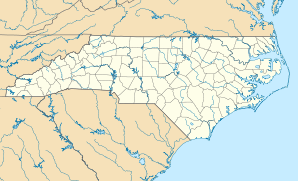
Cerro Gordo ist ein Ort (Populated Place) im Columbus County im südlichen US-Bundesstaat North Carolina. Laut Volkszählung im Jahre 2000 hatte sie eine Einwohnerzahl von 244 auf einer Fläche von 2,0 km². Die Bevölkerungsdichte liegt bei 122 pro km².
Wikimedia Foundation.
Schlagen Sie auch in anderen Wörterbüchern nach:
Cerro Gordo, North Carolina — Town Location of Cerro Gordo, North Carolina … Wikipedia
Cerro Gordo (Carolina del Norte) — Cerro Gordo Pueblo de los Estados Unidos Ubicació … Wikipedia Español
Cerro Gordo — ( Fat Hill in Spanish) may refer to several places: Mexico Cerro Gordo, Veracruz The Battle of Cerro Gordo in the Mexican American War Cerro Gordo, the mountain north of Teotihuacan Puerto Rico Cerro Gordo (Bayamón), one of the 12 settlements in… … Wikipedia
Cerro Gordo — ist der Name mehrerer Orte in den Vereinigten Staaten: Cerro Gordo (Illinois) Cerro Gordo (Minnesota) Cerro Gordo (North Carolina) Cerro Gordo (Tennessee) Cerro Gordo Ghost Town (California) Cerro Gordo County, Verwaltungseinheit in Iowa die… … Deutsch Wikipedia
Cerro Gordo — Cerro Gordo, NC U.S. town in North Carolina Population (2000): 244 Housing Units (2000): 102 Land area (2000): 0.755866 sq. miles (1.957685 sq. km) Water area (2000): 0.000000 sq. miles (0.000000 sq. km) Total area (2000): 0.755866 sq. miles… … StarDict's U.S. Gazetteer Places
Battle of Cerro Gordo — Infobox Military Conflict conflict=Battle of Cerro Gordo caption= partof=the Mexican American War date=April 18, 1847 place=Cerro Gordo, near Xalapa, Veracruz result=American victory combatant1=United States combatant2=Mexico commander1=Winfield… … Wikipedia
Cerro Gordo, NC — U.S. town in North Carolina Population (2000): 244 Housing Units (2000): 102 Land area (2000): 0.755866 sq. miles (1.957685 sq. km) Water area (2000): 0.000000 sq. miles (0.000000 sq. km) Total area (2000): 0.755866 sq. miles (1.957685 sq. km)… … StarDict's U.S. Gazetteer Places
North Carolina locations by per capita income — North Carolina is the twenty eighth richest state in the United States of America, with a per capita income of $20,307 (2000). North Carolina Places Ranked by Per Capita Income Rex, North Carolina $148,073 Biltmore Forest, North Carolina $85,044… … Wikipedia
North Carolina Highway 242 — NC 242 Route information Maintained by NCDOT Length: 93 mi (150 km) Existed … Wikipedia
Columbus County, North Carolina — Columbus County Courthouse, Whiteville … Wikipedia