Kirkstone Pass

Kirkstone Pass
54.475125-2.922549
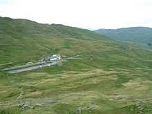
Der Kirkstone Pass. Blick auf das Kirkstone Pass Inn in südöstlicher Richtung

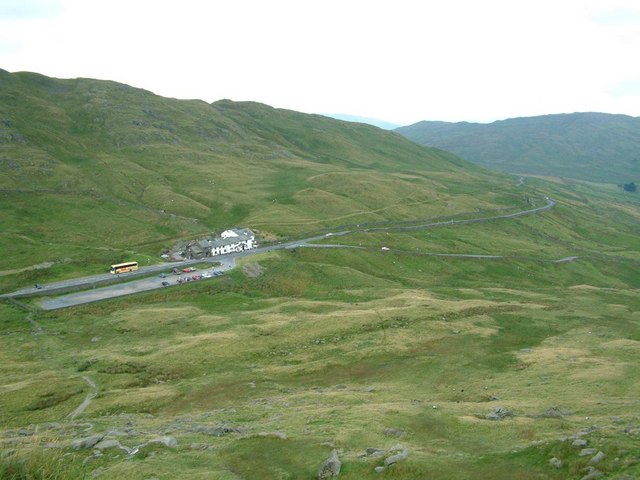
Der Kirkstone Pass ist ein Gebirgspass im Lake District in Cumbria, England.

Die A592 führt über den Pass und verbindet Ambleside mit Patterdale. Mit einer Höhe von 454 m ist er der höchste befahrbare Pass im Lake District.

Westlich des Passes liegt der Middle Dodd. Auf der östlichen Seite wird der Pass durch die Berge des Caudale Moor und den Hartsop Dott begrenzt.

Auf der nördlichen Seite des Pases unterhalb des Hartsop Dott liegt ein stillgelegter Steinbruch. Auf der südlichen Seite unweit der Passhöhe befindet sich das Kirkstone Pass Inn, das dritthöchste Pub in England.

Der Name des Passes stammt von einem Stein, dem Kirkstone, der neben der Straße in der Nähe des Pubs in Richtung Patterdale steht. Der Stein sieht einem Kirchturm ("kirk" heißt im Altnorwegischen "Kirche") ähnlich.

Weblinks


Wikimedia Foundation.

Игры ⚽ Нужно сделать НИР?

Schlagen Sie auch in anderen Wörterbüchern nach:

  • Kirkstone Pass — is a mountain pass in the English Lake District, in the county of Cumbria. It is at an altitude of convert|1489|ft|m|0.This is the Lake District s highest pass that is open to motor traffic and it connects Ambleside in the Rothay Valley to… …   Wikipedia

  • Red Screes — Infobox Mountain Name = Red Screes Photo = Red Screes.jpg Caption = Red Screes seen from Wansfell summit Elevation = 776 m (2,546 ft) Location = Cumbria, ENG Range = Lake District, Eastern Fells Prominence = c. 260 m Parent peak = Fairfield… …   Wikipedia

  • Stony Cove Pike — Infobox Mountain Name = Stony Cove Pike Photo = Cauldale moor Kirkstone pass.jpg Caption = Stony Cove Pike, seen from Red Screes, with the Kirkstone Pass intervening Elevation = 763 m (2,502 ft) Location = Cumbria, ENG Range = Lake District, Far… …   Wikipedia

  • Middle Dodd — from Red Screes, Brothers Water is seen beyond the summit. Elevation 654 m (2,146 ft) …   Wikipedia

  • Lake District — The Skiddaw massif, town of Keswick and Derwent Water seen from Walla Crag …   Wikipedia

  • Far Eastern Fells — The Far Eastern Fells are a group of hills in the English Lake District. Reaching their highest point at High Street (828 metres or 2,718 ft) they occupy a broad area to the east of Ullswater and Kirkstone Pass. Much quieter than the central… …   Wikipedia

  • Mountain Goat (bus company) — Mountain Goat Slogan Better by Goat / The Best Way To See Lakeland Founded 1972[1] Defunct No …   Wikipedia

  • Carmen (storm) — Formed 7 November 2010 Dissipated 19 November 2010 Countries or regions affected United States; Europe (including United Kingdom and Russia) Lowest pressure 948 mbar (hPa; 27.99  …   Wikipedia

  • Cue for Treason —   Cover of 1973 Puffin Books edition …   Wikipedia

  • Brothers Water — Infobox lake lake name = Brothers Water image lake = Brock Crags and Angle Tarn Pikes.jpg caption lake = Brotherswater seen from the south. From the top of High Hartsop Dodd image bathymetry = caption bathymetry = location = Lake District,… …   Wikipedia

Share the article and excerpts

Direct link
Do a right-click on the link above
and select “Copy Link”