Lake Berryessa

Lake Berryessa
Lake Berryessa
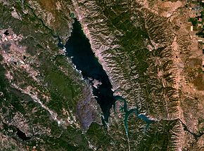
Satelliten-Foto
Satelliten-Foto
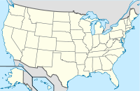
Lage: Kalifornien (USA)
Abflüsse: Putah Creek → Sacramento River
Lake Berryessa (USA)
Lake Berryessa
Koordinaten 38° 34′ 15,4″ N, 122° 14′ 6,9″ W38.570938888889-122.23526111111Koordinaten: 38° 34′ 15,4″ N, 122° 14′ 6,9″ W
Daten zum Bauwerk
Sperrentyp: Stausee
Daten zum Stausee
Wasseroberfläche bei Vollstau: 1490 km²dep1
Stauseelänge: 24,9 kmdep1
Stauseebreite: 4,8 kmdep1
Speicherraum: 1,976 km³dep1

Der Lake Berryessa ist ein Stausee in Napa County im US-Bundesstaat Kalifornien. Der See wurde nach den ersten europäischen Siedlern im Tal der Berryessa, José Jesús und „Sexto Sisto“ Berrelleza benannt, die im Jahre 1843 die Rancho Las Putas besiedelten.

Er umfasst eine Fläche von insgesamt 1490 km², die sich auf eine Länge von 24,9 km Länge sowie 4,8 km Breite verteilen. An seiner tiefsten Stelle ist der See etwa 84 m tief. Ein besonderes Merkmal des Berryessa Lake ist ein Loch Mitten im See, welches durch eine ingenieurstechnische Konstruktion Wasser mit dem Anblick eines Naturschauspiels abfließen lässt.[1]

Ein Panorama-Bild des Berryessa Lake

Weblinks

Einzelnachweise

  1. The Glory Hole

Wikimedia Foundation.

Игры ⚽ Поможем написать реферат

Schlagen Sie auch in anderen Wörterbüchern nach:

  • Lake Berryessa — Infobox lake lake name = Lake Berryessa image lake = Wfm lake berryessa landsat.jpg caption lake = Satellite photo image bathymetry = caption bathymetry = location = Napa County, California coords = coord|38.570938|N|122.23526|W|region:US CA type …   Wikipedia

  • Lake Berryessa — Sp Bèriesos ẽžeras Ap Lake Berryessa L JAV (Kalifornija) …   Pasaulio vietovardžiai. Internetinė duomenų bazė

  • Berryessa — may refer to some places in the United States:*Berryessa, San Jose, California *Berryessa Creek in San Jose, California *Berryessa (VTA) light rail station in San Jose, California *Lake Berryessa, California …   Wikipedia

  • Lac Berryessa — photo satellite du lac Berryessa selon la NASA Administration Pays …   Wikipédia en Français

  • Clear Lake State Park (California) — Clear Lake State Park Dorn Bay view from State Park Location Lake County, California …   Wikipedia

  • Mono Lake Tufa State Reserve — Mono Lake s South Tufa a …   Wikipedia

  • Clear Lake National Wildlife Refuge — in northeastern California consists of approximately 20,000 acres (81 km2) of open water surrounded by over 26,000 acres (110 km2) of upland bunchgrass, low sagebrush, and juniper habitat. Small, rocky islands in the lake provide… …   Wikipedia

  • Zodiac Killer — For the New York City Zodiac copycat, see Heriberto Seda. For the Japanese Zodiac copycat, see Seito Sakakibara. Zodiac Killer A sketch of the Zodiac Killer based on witness testimonies Background information Birth …   Wikipedia

  • Rancho Las Putas — was a 35,516 acre (143.73 km2) Mexican land grant in present day Napa County, California given in 1843 by Governor Manuel Micheltorena to José de Jesús Berreyesa and Sexto Sisto Berreyesa. The name Las Putas came from Putah Creek, which ran… …   Wikipedia

  • Asesino del Zodiaco — Saltar a navegación, búsqueda Retrato de un ponente, que el testimonio de los testigos de la policía El Asesino del Zodíaco fue un asesino en serie que actuó en el Norte de California durante 10 meses desde finales de los años 60. Él mismo eligió …   Wikipedia Español

Share the article and excerpts

Direct link
Do a right-click on the link above
and select “Copy Link”