Lake Omapere

Lake Omapere
Lake Omapere

Photo-request.svg

Bild gesucht 

BW

Geographische Lage Far North Distrikt, Northland , Neuseeland
Abfluss Utakura River
Städte am Ufer Lake Omapere, Okaihau
Größere Städte in der Nähe Kaikohe
Daten
Koordinaten 35° 20′ 46″ S, 173° 47′ 20″ O-35.346111111111173.78888888889237Koordinaten: 35° 20′ 46″ S, 173° 47′ 20″ O
Lake Omapere (Neuseeland)
Lake Omapere
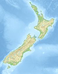
Höhe über Meeresspiegel 237 m
Fläche 14 km²dep1f5
Maximale Tiefe 2-3 mdep1f10
Besonderheiten

durch einen Lavastrom aufgestauter Flusslauf

Lake Omapere ist ein kleiner See, aber der größte [1] in der Region Northland auf der Nordinsel Neuseelands. Er liegt etwa 5 km nördlich von Kaikohe. Der State Highway 1 verläuft in der Nähe des Nordufers, der State Highway 12 führt etwa 3 km südöstlich vorbei. [2]

Der See ist 5 km lang und 14 km² groß, die Wassertiefe liegt ziemlich konstant zwischen 2 m und 3 m. Der Seespiegel liegt 237 m über dem Meeresspiegel. Der See hat ein Einzugsgebiet von nur 1700 Hektar [1]. Das Lake Omapere Restoration and Management Project versucht, eine freiwillige Umweltmanagementstrategie zum Schutz des unter Landwirtschaftsabwässen leidenden [1] Sees umzusetzen.

Der See entstand, als ein Tal durch einen Lavastrom der nahe dem Seeufer stehenden Vulkane blockiert wurde und das Wasser sich aufstaute. Dabei wurden Bäume überschwemmt, deren Stümpfe noch heute unter Wasser vorhanden sind. Der Vulkanismus ist noch heute am Südwestufer in Form heißer Sodaquellen aktiv. [3]

Im Sumpfland um den See wächst das heimische Gras Mapere, das dem See seinen Namen gab.

Einzelnachweise

  1. a b c scoop.co.nz, abgerufen 10.Juni 2009
  2. New Zealand Travel Atlas, Wise Maps Auckland. ISBN 0-908794-47-9
  3. Enzyklopedia of New Zealand 1966

Wikimedia Foundation.

Игры ⚽ Нужно решить контрольную?

Schlagen Sie auch in anderen Wörterbüchern nach:

  • Lake Omapere — Location Far North District, Northland Region, North Island Coordinates 35°21′S …   Wikipedia

  • Okaihau Branch — [v · d · …   Wikipedia

  • Aboriginal title — Protests of the Foreshore and Seabed Act 2004, extinguishing aboriginal title to the foreshore and seabeds in New Zealand Aboriginal title is a common law doctrine that the land rights of indigenous peoples to customary tenure persist after the… …   Wikipedia

  • Flagstaff War — Infobox Military Conflict conflict=Flagstaff War partof=New Zealand Wars caption= date=11 March 1845 11 January 1846 place=Northland, New Zealand result=Stalemate combatant1= Māori allies combatant2= Ngā Puhi commander1=flagicon|United Kingdom Lt …   Wikipedia

  • Wairere Boulders — The Wairere Boulders are an unusually large assemblage of basalt boulders in the Hokianga, in the far north of New Zealand. The boulder area, surrounded by subtropical rainforest, has been transformed into a park area to enable visitors to view… …   Wikipedia

  • Kaikohe — is the central service area for the Far North District of New Zealand, about 260 km from Auckland, situated on State Highway 12 at coord|35|24|S|173|48|E|. It is the largest inland town and highest community above sea level in the Northland… …   Wikipedia

  • Waimate North — Infobox Settlement name = Waimate North subdivision type = Country subdivision name = New Zealand subdivision type1= Region subdivision name1= Northland Region subdivision type2= District subdivision name2= Far North District pushpin latd = 35… …   Wikipedia

  • Kaikohe — Kaikohe …   Deutsch Wikipedia

  • Okaihau-Nebenbahn — Streckenlänge: 40 km Legende …   Deutsch Wikipedia

  • Okaihau — p1 Okaihau …   Deutsch Wikipedia

Share the article and excerpts

Direct link
Do a right-click on the link above
and select “Copy Link”