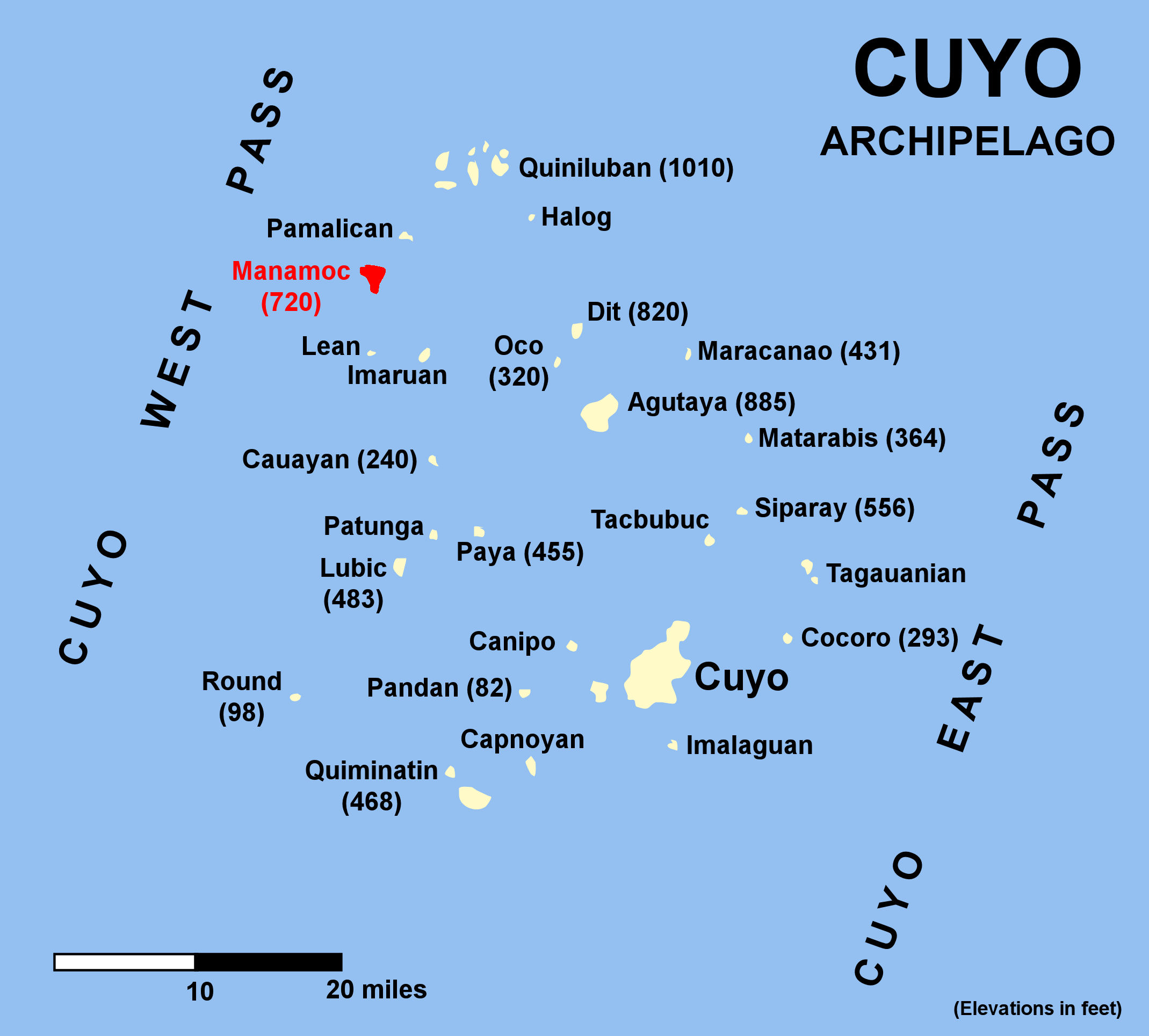
- Manamoc
-
Manamoc Manamoc von Norden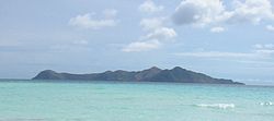
Gewässer Sulusee Inselgruppe Quiniluban Geographische Lage 11° 18′ 10″ N, 120° 40′ 52″ O11.302777777778120.68111111111Koordinaten: 11° 18′ 10″ N, 120° 40′ 52″ O 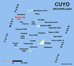
Länge 3,2 km Breite 2,7 km Fläche 5,16 km² Einwohner 1.900
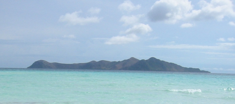
368 Einw./km²Hauptort Manamoc Manamoc ist eine Insel in der Quiniluban-Gruppe der Cuyo-Inseln in der Sulusee der Philippinen zwischen Palawan und Panay im Norden der Palawan-Region in MIMAROPA. Sie liegt nahe dem Amanpulo-Resort auf der Insel Pamalican.[1]
Inhaltsverzeichnis
Beschreibung
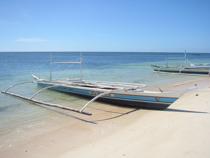
Die 1900 Einwohner der 5,16 km² großen Insel leben im Wesentlichen von Fischfang, Algenernte, Landwirtschaft und von Unterstützung durch die philippinische Regierung. Einige Bewohner sind auch auf dem benachbarten Resort Amanpulo beschäftigt. Die Bewohner haben mit Erfolg eine gut einen Quadratkilometer große marine Schutzzone zum Schutz von Korallen eingerichtet.
Die Insel ist verhältnismäßig wohlhabend und sauber. Sie ist gut ausgestattet mit Einrichtungen für Kinder. Energie wird durch an mehreren Stellen installierte Solarzellen geliefert. Der katholische Glaube ist vorherrschend. Tourismus existiert so gut wie nicht außer gelegentlichen Bootsbesuchen neugieriger Touristen aus dem Pamalican-Resort.
-

Fischerboote
-
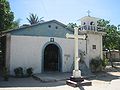
Katholische Kirche
Wetter
Das Wetter wird weitgehend von dem trockenen und windigen Nordost-Passat von Januar bis Mai bestimmt und vom niederschlagsreichen Südwest-Monsun von Juni bis November, mit einer hohen Wahrscheinlichkeit für Zyklone zwischen August und November.
Wetter (1951–1985) Monat Regen
(mm)Regentage Bewölkung
(in Achtel)Jan
Feb
Mär
Apr
Mai
Jun
Jul
Aug
Sep
Okt
Nov
Dez
Jährlich13.2
2.5
8.2
44.1
187.3
376.2
437.7
409.7
375.0
272.1
148.2
51.1
2329.32
1
1
3
13
20
22
21
20
17
9
4
1335
5
4
4
6
7
7
8
7
6
6
6Weblinks
Einzelnachweise
Kategorien:- Insel (Philippinen)
- Insel (Asien)
- Insel (Pazifischer Ozean)
- Geographie (Philippinen)
-

Wikimedia Foundation.