Maquinna Marine Provincial Park
- Maquinna Marine Provincial Park
-
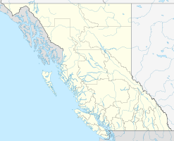
Der Maquinna Marine Provincial Park ist ein Park im Clayoquot Sound im Westen der kanadischen Provinz British Columbia. Er liegt nordwestlich von Tofino und ist nur per Boot oder Flugzeug von dort oder von Ahousaht oder Hotsprings Village zu erreichen. Er umfasst eine Fläche von 2667 ha, davon befinden sich 1269 ha auf dem Land, dazu kommen 1398 ha geschütztes Meeresgebiet. Dabei erstreckt er sich von Hot Springs Cove bis Hesquiat Harbour.
Mehrere Stämme der Nuu-chah-nulth besitzen dort heilige Stätten, die unter besonderem Schutz stehen, aber auch, wie die Hesquiaht First Nation, einen Campingplatz. Westlich vom Park befindet sich der Hesquiat Peninsula Provincial Park, südöstlich der Flores Island Provincial Park auf der namengebenden Insel.
Geschichte
Der Park wurde 1955 als Schutzgebiet für die Meeresfauna und -flora gegründet; die ersten 35 Acre stellte das Ehepaar Clarke aus Hot Springs Cove zur Verfügung. Sein Name, der 1995 eingeführt wurde, verweist auf Häuptling Maquinna. Diesen Namen trugen mehrere Führer der Mowachaht, die für die Geschichte der Provinz von erheblicher Bedeutung sind. 1990 wurde der Park um die Openit Peninsula erweitert, die rund 39 ha umfasst. 1995 kam der Hesquiat Harbour hinzu.
Weblinks
Wikimedia Foundation.
Schlagen Sie auch in anderen Wörterbüchern nach:
Maquinna Marine Provincial Park — is a provincial park in British Columbia, Canada, located northwest of Tofino in the Clayoquot Sound region of the West Coast of Vancouver Island, protecting Ramsay Hot Springs, which is the name source of the cove, settlement and former post… … Wikipedia
Maquinna — (Maquilla, selten Muquinna) ist der Name einer ganzen Reihe von Nuu chah nulth Häuptlingen, genauer der Mowachaht, die ihr Wohngebiet an der Westküste von Vancouver Island haben. Zwei von ihnen spielten für die Phase der ersten Kontakte zwischen… … Deutsch Wikipedia
Provincial Parks in British Columbia — Karte der Provincial Parks in British Columbia Die kanadische Provinz British Columbia unterhält 620 Provincial Parks (Stand: November 2010). Damit besitzt die Provinz nach den kanadischen Nationalparks das größte Parksystem des Landes. Über 13,5 … Deutsch Wikipedia
List of British Columbia Provincial Parks — The following is a list of all British Columbia land currently managed by [http://www.env.gov.bc.ca/bcparks BC Parks] . Any parks that are closed are not currently listed.There were a number of provincial parks, protected areas and ecological… … Wikipedia
Muquinna — Maquinna (Maquilla, selten Muquinna) ist der Name einer ganzen Reihe von Nuu chah nulth Häuptlingen, genauer der Mowachaht, die ihr Wohngebiet an der Westküste von Vancouver Island haben. Zwei von ihnen spielten für die Phase der ersten Kontakte… … Deutsch Wikipedia
Tofino, British Columbia — Infobox Settlement official name = Tofino, British Columbia other name = native name = nickname = settlement type = Village motto = imagesize = image caption =Fish Wharf in Tofino flag size = image seal size = image shield = shield size = image… … Wikipedia
Hot springs around the world — There are hot springs on all continents and in many countries around the world. Countries that are renowned for their hot springs include Iceland, New Zealand, Chile and Japan, but there are interesting and unique hot springs in many other places … Wikipedia
Alberni-Clayoquot Regional District — The Alberni Clayoquot Regional District (2006 population 30,664) of British Columbia is located on west central Vancouver Island. It is bounded by the Strathcona Regional District to the north, and by the Nanaimo and Cowichan Valley Regional… … Wikipedia
District Régional De Alberni-Clayoquot — Le district régional de Alberni Clayoquot en Colombie Britannique est situé dans le centre ouest de l île de Vancouver. Il est entouré du district régional de Comox Strathcona au nord et par le district régional de Nanaimo et le district régional … Wikipédia en Français
District regional de Alberni-Clayoquot — District régional de Alberni Clayoquot Le district régional de Alberni Clayoquot en Colombie Britannique est situé dans le centre ouest de l île de Vancouver. Il est entouré du district régional de Comox Strathcona au nord et par le district… … Wikipédia en Français