- Maskavas forštate
-
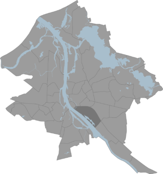
Maskavas forštate (deutsch: Moskauer Vorstadt) ist ein Stadtteil der lettischen Hauptstadt Riga. Er wird auch Maskavas priekšpilsēta oder umgangssprachlich Maskačka genannt.
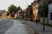
Er liegt südlich der Innenstadt im Bezirk Latgales priekšpilsēta am Ufer der Daugava. Auf 749 Hektar Fläche leben 32.157 Einwohner (2008). Der Stadtteil hat seinen Namen von der ihn durchquerenden früheren Landstraße nach Moskau, Maskavas iela, und wurde traditionell vorwiegend von Russen bewohnt. Im Zweiten Weltkrieg befand sich hier das Ghetto Riga.
Der Kultur- und Wissenschaftspalast (Zinātņu akadēmijas augstceltne), der Rigaer Zentralmarkt, die aus Holz im klassizistischen Stil erbaute protestantische Jesuskirche (Jēzus Evaņģēliski luteriskā baznīca) sowie die Ruinen einer Synagoge befinden sich in Maskavas forštate.
Weblinks
- Informationen der Stadtverwaltung (lettisch)
Verwaltungsgliederung RigasCentra rajons: Centrs | Vecpilsēta
Kurzemes rajons: Āgenskalns | Bolderāja | Daugavgrīva | Dzirciems | Iļģuciems | Imanta | Kleisti | Ķīpsala | Rītabuļļi | Spilve | Voleri | Zasulauks
Zemgales priekšpilsēta: Āgenskalns | Atgāzene | Beberbeķi | Bieriņi | Bišumuiža | Katlakalns | Mūkupurvs | Pleskodāle | Salas | Šampēteris | Torņakalns | Ziepniekkalns | Zolitūde
Ziemeļu rajons: Čiekurkalns | Jaunciems | Kundziņsala | Mangaļsala | Mežaparks | Mīlgrāvis | Pētersala-Andrejsala | Sarkandaugava | Trīsciems | Vecāķi | Vecdaugava | Vecmīlgrāvis
Vidzemes priekšpilsēta: Berģi | Brasa | Brekši | Bukulti | Dreiliņi | Jugla | Mežciems | Purvciems | Skanste | Suži | Teika
Latgales priekšpilsēta: Avotu iela | Dārzciems | Dārziņi | Grīziņkalns | Ķengarags | Maskavas forštate | Pļavnieki | Rumbula | Šķirotava
Wikimedia Foundation.


