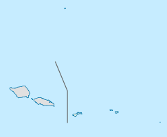
Matafao

Matafao
Matafao
Matafao

Matafao

Höhe 653 m
Lage Insel Tutuila, Amerikanisch-Samoa
Geographische Lage 14° 17′ 50″ S, 170° 42′ 30″ W-14.297222222222-170.70833333333653Koordinaten: 14° 17′ 50″ S, 170° 42′ 30″ W
Matafao (Amerikanisch-Samoa)
Matafao
Gestein Basalt, Andesit

Der Matafao, auch Matafao Peak, ist die höchste Erhebung der Insel Tutuila in Amerikanisch-Samoa im zentralen Pazifischen Ozean. Er stellt den höchsten von zahlreichen Gipfeln eines einstigen Schildvulkans dar, die sich um die 9 km breite, nach Süden offene Bucht von Pago Pago, die einstige Caldera des Vulkans, reihen. Der Berg gehört nicht zum Nationalpark von Amerikanisch-Samoa, bildet jedoch eine eigene National Natural Landmark.

Weblinks


Wikimedia Foundation.

Игры ⚽ Поможем решить контрольную работу

Schlagen Sie auch in anderen Wörterbüchern nach:

  • Mount matafao different snail — Taxobox name = Mount matafao different snail status = EX | status system = IUCN2.3 regnum = Animalia phylum = Mollusca classis = Gastropoda ordo = Stylommatophora familia = Helicarionidae genus = Diastole species = D. matafaoi binomial = Diastole …   Wikipedia

  • Mount Matafao different snail — Conservation status Extinct (IUCN 2.3)[1] …   Wikipedia

  • Tutuila — Tutuila, Amalu Bucht Gewässer Pazifischer Ozean Inselgruppe …   Deutsch Wikipedia

  • List of extinct animals of North America — This is an incomplete list of extinct animals of North America. This list covers only extinctions from the Holocene epoch, a geological period that extends from the present day back to about 10,000 radiocarbon years, approximately 11,430 ± 130… …   Wikipedia

  • List of mountains of the United States — This list of mountains of the United States includes significant mountain peaks and high points located in the United States of America arranged alphabetically by state, district, or territory.ignificant mountain peaks and high points Alabama… …   Wikipedia

  • Samoan Islands — For other uses, see Samoa (disambiguation). Samoan Islands Olosega island in the Manu a group, eastern Samoa Islands …   Wikipedia

  • Tutuila — is the main or largest island of American Samoa, and the third largest island in the Samoan Islands chain. The island is distinctive in the Central Pacific for its large, natural harbor mdash;Pago Pago Harbor mdash;on which the capital of… …   Wikipedia

  • Pago Pago International Airport — IATA: PPG – ICAO: NSTU – FAA LID: PPG Summary Airport type Public Owner American Samoa Government …   Wikipedia

  • American Samoa Department of Education — operates public schools in American Samoa, an insular area of the United States.choolsecondary schools* Fagaitua High School [http://www.doe.as/index files/schoolWebsites/Vikings.htm] * Leone High School * Manu a High School * Nu uli Polytechnic… …   Wikipedia

  • Tutuila — Géographie Pays …   Wikipédia en Français

Share the article and excerpts

Direct link
Do a right-click on the link above
and select “Copy Link”