Mount Liamuiga

Mount Liamuiga

f1

Mount Liamuiga
Höhe 1.156 m
Lage St. Kitts
Geographische Lage 17° 22′ 0″ N, 62° 48′ 0″ W17.366666666667-62.81156Koordinaten: 17° 22′ 0″ N, 62° 48′ 0″ W
Mount Liamuiga (St. Kitts und Nevis)
Mount Liamuiga
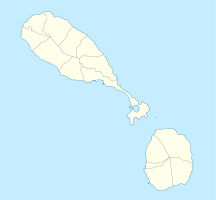
Typ Schichtvulkan
Letzte Eruption 160

Der Mount Liamuiga (auch: Mount Misery) ist ein 1.156 m hoher Stratovulkan auf der karibischen Insel St. Kitts.

Im steilwandigen Krater, der einen Durchmesser von etwa einem Kilometer aufweist, lag bis 1959 ein flacher Kratersee. Heute findet man im Inneren des Kraters aktive Fumarolen. An den Flanken des Vulkans befinden sich mehrere Lavadome. Bei den letzten Ausbrüchen vor weniger als 2000 Jahren kam es zu pyroklastische Ströme und Schlammlawinen, deren Material heute die Küstengebiete am Fuß des Vulkans aufbaut. 1692 und 1843 wurde von weiteren Ausbrüchen berichtet, die heute jedoch angezweifelt werden. Zwischen 1988 und 1989 sowie zwischen 1999 und 2000 kam es zu mehreren Erdbeben, die Erdrutsche im Kraterinneren nach sich zogen.

Weblinks


Wikimedia Foundation.

Игры ⚽ Нужна курсовая?

Schlagen Sie auch in anderen Wörterbüchern nach:

  • Mount Liamuiga — Mount Liamuiga …   Wikipedia

  • Mount Liamuiga — Sp Liamuigà Ap Mount Liamuiga L ugnk. Sent Kitse ir Nevyje (Sent Kitso s.) …   Pasaulio vietovardžiai. Internetinė duomenų bazė

  • Mount Misery — or Misery Mountain may refer to: Contents 1 Summits 1.1 In the United States 1.2 Elsewhere 2 Other locations …   Wikipedia

  • Liamuiga — Sp Liamuigà Ap Mount Liamuiga L ugnk. Sent Kitse ir Nevyje (Sent Kitso s.) …   Pasaulio vietovardžiai. Internetinė duomenų bazė

  • Monte Liamuiga — Tipo Estratovolcán Ubicación Isla de San Cristóbal  • Coordenadas …   Wikipedia Español

  • Mountain peaks of the Caribbean — Main article: Caribbean Sea See also: Mountain peaks of North America Contents 1 Highest major summits 2 Most prominent summits …   Wikipedia

  • Table of the most isolated major summits of North America — Main article: Mountain peaks of North America See also: Table of the highest major summits of North America, Table of the most prominent summits of North America, and Table of the major 100 km summits of North America The following sortable… …   Wikipedia

  • Saint John Capisterre Parish — Geobox Region name = Saint John Capisterre native name = other name = other name1 = category = Parish image size = image caption = flag size = symbol = symbol size = country = Saint Kitts and Nevis state = region = district = capital = Dieppe Bay …   Wikipedia

  • Saint Kitts — Infobox Islands name = Saint Christopher image caption = Map of Saint Kitts image size = locator map custom = no native name = native name link = nickname = Saint Kitts location = Caribbean Sea coordinates = coord|17|15|N|62|40|W|display=inline… …   Wikipedia

  • Table of the major 100 km summits of North America — Main article: Mountain peaks of North America The following sortable table lists the 234 mountain peaks of greater North America with at least 100 kilometers (62.14 miles) of topographic isolation and at least 500 meters… …   Wikipedia

Share the article and excerpts

Direct link
Do a right-click on the link above
and select “Copy Link”