- Mount Peulik
-
Mount Peulik 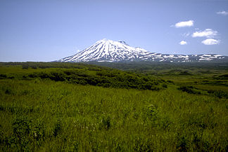
Mount Peulik von Norden
Höhe 1.474 m Lage Alaska, USA Gebirge Aleutenkette Geographische Lage 57° 45′ 4″ N, 156° 22′ 5″ W57.751-156.3681474Koordinaten: 57° 45′ 4″ N, 156° 22′ 5″ W 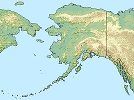

Typ Stratovulkan Letzte Eruption 1814 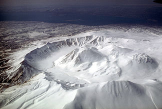
Ugashik-Caldera, Luftbild, Blickrichtung Südwest
Mount Peulik, auch Ugashik-Peulik, ist ein Stratovulkan auf der Alaska-Halbinsel im US-Bundesstaat Alaska.
Er liegt als Teil der Aleutenkette südlich des Becharof Lake im Lake and Peninsula Borough nördlich der Ugashik-Caldera und ist 1474 m hoch. Sein letzter Ausbruch fand 1814 statt.
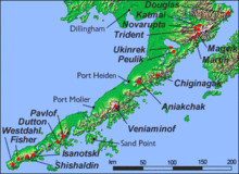 Karte mit Vulkanen Alaskas
Weblinks
 Commons: Ugashik-Peulik – Sammlung von Bildern, Videos und Audiodateien
- Ugashik-Peulik im Global Volcanism Program der Smithsonian Institution (englisch)
- Volcanoes of the Alaska Peninsula and Aleutian Islands – mit Link zu Fotos
- Alaska Volcano Observatory
Kategorien:- Eintausender
- Schichtvulkan
- Berg in Alaska
- Berg in Nordamerika
- Berg in der Aleutenkette
- Lake and Peninsula Borough


Wikimedia Foundation.