- Myponga Reservoir
-
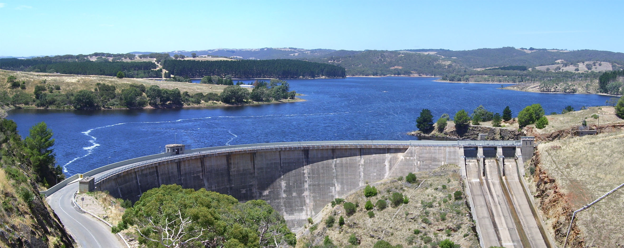
Myponga Reservoir Bild der Staumauer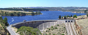
Lage: South Australia Zuflüsse: Myponga River Größere Orte in der Nähe: Myponga 

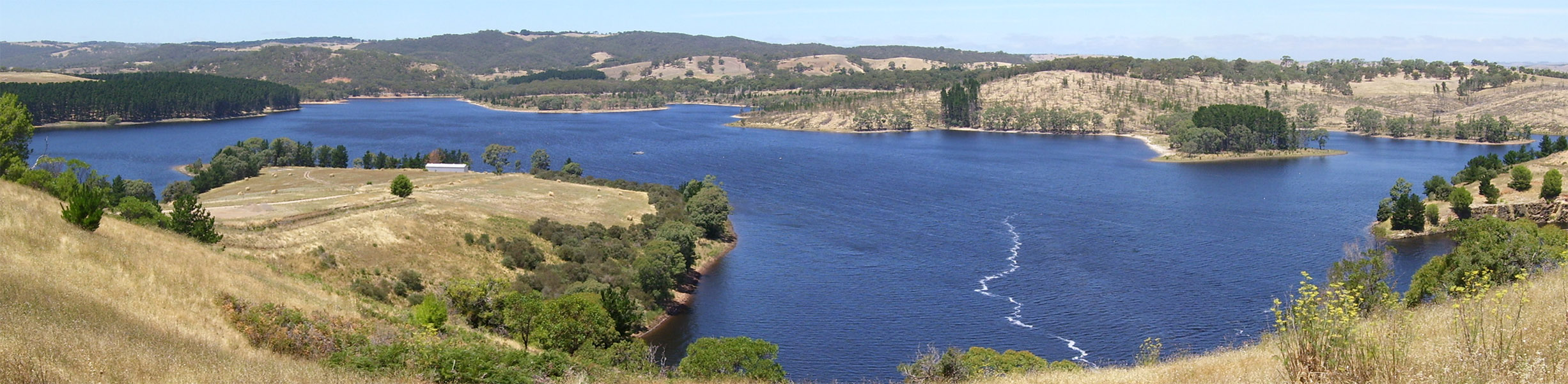
Koordinaten 35° 23′ 42″ S, 138° 26′ 31,2″ O-35.395138.442Koordinaten: 35° 23′ 42″ S, 138° 26′ 31,2″ O Daten zum Bauwerk Bauzeit: 1957–1962 Höhe des Absperrbauwerks: 49 m Kronenlänge: 228 m Daten zum Stausee Wasseroberfläche bei Vollstau: 2,8 km² Speicherraum: 26.8 Mio m³ Der Myponga-Stausee (englisch: Myonga Reservoir) liegt etwa 60 km südlich von Adelaide in South Australia, nahe der Ortschaft Myponga. In den Stausee, der in den südlichen Mount Lofty Ranges liegt, fließt der Myponga River und weitere Gewässer des Mypona-Wassereinzugsgebiets.
Etwa 5 % des Trinkwassers dieses Staudamms wird von Adelaide genutzt[1] und bildet die Hauptreserve von Adelaide und der Südküste Australiens. Pläne das Wassereinzugsgebies des Myponga River als Trinkwasserreserve zu nutzen, wurden bereits 1945 gemacht, der Staudammbau begann 1957 und wurde 1962 fertiggestellt. Der Staudamm wird nicht – wie in vielen anderen Fällen – durch den Murray River gespeist, sondern durch sein lokales Wassereinzugsgebiet. Aus dem Staudamm fließt der Myponga River weiter bis in den Golf St. Vincent, wo er am Myponga Beach einmündet. Der Myponga Reservoir Treatment Plant wurde 1993 verwirklicht und versorgt etwa 50.000 Menschen eines Gebietes, das sich über das Gebiet vom McLaren Vale, ein Weinanbaugebiet, bis zum Victor Harbor erstreckt.[2]
Myponga Reservoir, von der Reservoirstraße aus betrachtet.Weblinks
Einzelnachweise
- ↑ Department of Environment and Heritage, Government of South Australia The Myponga River Catchment, abrufen am 20 Februar 2011
- ↑ District Council of Yankalilla. Myponga Reservoir, abgerufen am 20. Februar 2011
Kategorien:- Staudamm in Australien
- Stausee in Australien und Ozeanien
- See in South Australia

Wikimedia Foundation.