- N’Gourti
-
15.33083333333313.200555555556Koordinaten: 15° 20′ N, 13° 12′ O
N’Gourti (amtliche Schreibweise[1]; auch Ngourti) ist eine Landgemeinde im Departement N’Guigmi der nigrischen Region Diffa. Sie hat 28.754 Einwohner (2010).[2]
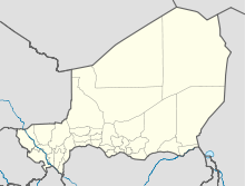
N’Gourti liegt in der Sahelzone im Südosten des Landes. In geologischer Hinsicht befindet sich die Gemeinde in einem dem Erdzeitalter Quartär zugerechneten Gebiet.[3] Der kleine, in einer Niederung gelegene Garnisonsort der nigrischen Armee ist von hohen Dünen umgeben. Die Ortschaft ist seit 2002 eine eigenständige Gemeinde (französisch: commune). Das Gemeindegebiet ist in 23 administrative Dörfer, ein traditionelles Dorf, 16 Weiler, 21 Lager und 118 Wasserstellen gegliedert.[4] N’Gourti ist eine Sprachgrenze für die zwei Sprachen der Volksgruppe der Tubu: Nördlich des Orts wird Tedaga gesprochen, südlich davon Dazaga.[5] Rund 100 Kilometer nordwestlich von N’Gourti wird seit 2009 Erdöl gefördert.[6]
Einzelnachweise
- ↑ Website des Institut Nationale de la Statistique du Niger: Annuaire statistique 2003–2007 (pdf), abgerufen am 18. Februar 2010.
- ↑ Institut national de la statistique (Hrsg.): Annuaire statistique des cinquante ans d’indépendence du Niger. Niamey 2010 (Online-Version), S. 53.
- ↑ Thomas Krings: Sahelländer. WBG, Darmstadt 2006, ISBN 3-534-11860-X, S. 16.
- ↑ Répertoire National des Communes (RENACOM). Website des Institut National de la Statistique, abgerufen am 22. Januar 2011.
- ↑ Jolijn Geels: Niger. Bradt, Chalfont St Peter 2006, ISBN 1-84162-152-8, S. 30.
- ↑ Niger 2009. Nouvelle édition de l'Université, Paris 2009, ISBN 2-7469-1640-1, S. 153.
Wikimedia Foundation.

