Navigator Peak

Navigator Peak
Navigator Peak

Photo-request.svg

Bild gesucht 

BWf1

Höhe 1.910 m
Lage Antarktis
Gebirge Heritage Range, Ellsworthgebirge
Geographische Lage 79° 22′ 30″ S, 85° 48′ 0″ W-79.375-85.81910Koordinaten: 79° 22′ 30″ S, 85° 48′ 0″ W
Navigator Peak (Antarktis)
Navigator Peak

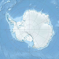
Navigator Peak ist ein markanter, spitzer Gipfel mit einer Höhe von 1.910 m in der westantarktischen Heritage Range, dem südlichen Teil des Ellsworthgebirges. Er befindet sich am nördlichen Ende der Geländestufe White Escarpment, etwa 7,4 km östlich des Zavis Peak.[1] Ein Gould Spur genannter Ausläufer erstreckt sich vom Navigator Peak aus in nordöstlicher Richtung zum Splettstoesser-Gletscher.[2]

Der Gipfel erhielt seinen Namen von einer geologischen Expedition der University of Minnesota, die das Gebiet im Sommer 1963/64 erkundete. Man nannte ihn Navigator Peak, da er als Orientierungspunkt für Navigatoren und Piloten diente, die von Flügen in den südlichen Teil der Heritage Range zum Lager der Expedition zurückkehrten.[1]

Einzelnachweise

  1. a b Navigator Peak (Englisch). Geographic Names Information System. United States Geological Survey. Abgerufen am 6. Dezember 2010.
  2. Gould Spur (Englisch). Geographic Names Information System. United States Geological Survey. Abgerufen am 6. Dezember 2010.

Wikimedia Foundation.

Игры ⚽ Поможем написать курсовую

Schlagen Sie auch in anderen Wörterbüchern nach:

  • Navigator Peak — (79°23′S 85°48′W / 79.383°S 85.8°W / 79.383; 85.8) is a sharp and prominent peak, 1,910 m, standing 4 nautical miles (7 km) east of Zavis Peak in the north part of the Whit …   Wikipedia

  • Zavis Peak — (coord|79|23|S|86|8|W|) is a sharp peak, 2,195 m, standing 4 miles (6 km) west of Navigator Peak at the south end of Founders Escarpment in the Heritage Range. Named by the University of Minnesota Geological Party, 1963 64, for Alfred Zavis,… …   Wikipedia

  • Decca Navigator System — D …   Wikipedia

  • White Escarpment — 79.483333333333 85.616666666667 Koordinaten: 79° 29′ S, 85° 37′ W …   Deutsch Wikipedia

  • Gould Spur — 79.35 85.666666666667 Koordinaten: 79° 21′ S, 85° 40′ W …   Deutsch Wikipedia

  • Mount Twiss (Antarktis) — Mount Twiss Bild gesucht  BWf1 Höhe 2.000  …   Deutsch Wikipedia

  • Thompson Nunataks — 79.45 85.816666666667 Koordinaten: 79° 27′ S, 85° 49′ W …   Deutsch Wikipedia

  • Hood, Mount — Peak, northwestern Oregon, U.S. Located in the Cascade Range at 11,235 ft (3,424 m), it is an extinct volcano that last erupted с 1865. The snowcapped peak, the highest mountain in the state, is the focal point of Mount Hood National Forest, a… …   Universalium

  • List of Russian explorers — The Russian Empire at its peak in 1866, including the spheres of influence; this territorial expansion largely corresponds to the extent of contiguous exploration by Russians. This is a list of explorers from the Russian Federation, Soviet Union …   Wikipedia

  • Internet Explorer — Windows Internet Explorer A component of Microsoft Windows Internet Explorer 9 in Wi …   Wikipedia

Share the article and excerpts

Direct link
Do a right-click on the link above
and select “Copy Link”