- Oval Barrow
-
 Der nicht mehr ovale Barrow auf dem Whiteleaf Hill
Der Oval Barrow ist prähistorischer Grabhügeltyp aus dem Neolithikum und der frühen Bronzezeit, der vor allem in Ostengland vorkommt. Er stellt eventuell den Übergang zwischen den älteren Long Barrows und den jüngeren Round und Disc Barrows dar. Der Erdhügel wurde mit einer großen Bandbreite (Typen A-F) über etwa 800 Jahre errichtet.
Einer der ältesten Oval Barrows ist der Thickthorn Barrow in Dorset (3.200 v. Chr), einer der jüngsten der Alfriston Barrow (2360 v. Chr.) in East Sussex. Der ovale Hügel unter dem Wayland’s Smithy wurde mit einem Langhügel überbaut. An einigen Stellen scheinen freistehende Holzhütten vor dem Hügel errichtet worden zu sein. Vier Phasen zeichnen sich bei der Entwicklung des ovalen Barrows von Barrow Hills, Abingdon in Oxfordshire ab.
Ovale Grabhügel finden sich vor allem in Buckinghamshire, Dorset, Kent, Oxfordshire, Sussex und Yorkshire. Sie enthalten zumeist eine Reihe von Gruben mit Brandbestattungen und Grabbeigaben der Glockenbecherkultur. Häufig wurde ein älterer Steinhügel lediglich mit einer Erdaufschüttung überhöht. Das benötigte Material wurde aus dem ovalen Graben gewonnen, der den Hügel umgab. Dieser mitunter unsymmetrische Graben scheint sukzessiv entstanden zu sein. In die Hügel gegrabene Schächte sind vage Anzeichen für die Beseitigung alter und die Einbringung neuer Gräber. Einer der Tumuli zeigt, dass die Bestattungen über einen längeren Zeitraum erfolgten, wobei die Gruben jeweils um 90 Grad versetzt zu ihren Vorgängern angelegt wurden.
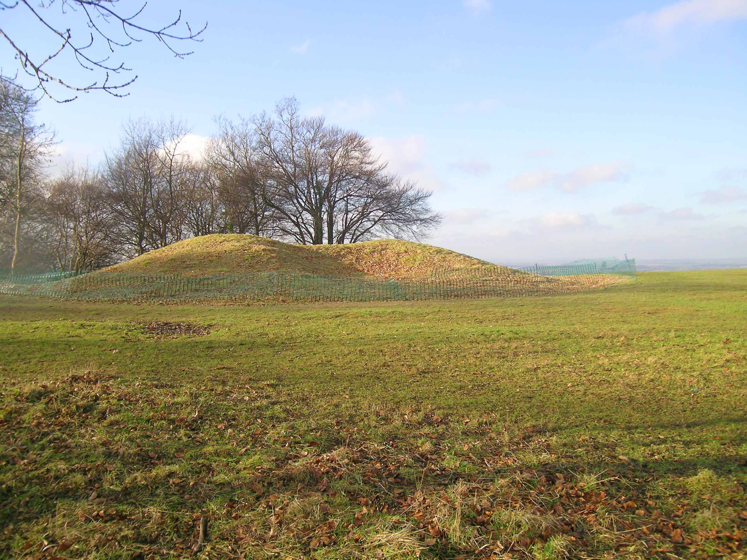
Whiteleaf Hill
Der Barrow in der Nähe der Kuppe des Whiteleaf Hill, bei Monks Risborough, in Buckinghamshire ist an einer Langseite eingedrückt und hat einen nierenförmigen Grundriss. Er stammt aus dem Neolithikum und wurde 1934 und 1939 von Lindsay Scott untersucht und erneut zwischen 2002 und 2006 ausgegraben. Der Hügel enthielt eine einzige Bestattung. Die C14-Datierung ergab, dass der Komplex Ende des 4. Jahrtausends v. Chr. entstand bzw. genutzt wurde. Die Relikte fanden sich zwischen zwei 1,2 m voneinander entfernt aufgestellten Pfosten. Scherben von Tonware und Tierknochen fanden sich in der Mitte des Hügels. Sie deuten darauf hin, dass anlässlich der feierlichen Gründungszeremonie des Hügels ein Mahl stattfand.
Literatur
- R. Bradley: The excavation of an oval barrow beside the Abingdon causewayed enclosure. Oxfordshire , Proceedings of the Prehistoric Society vol.58 (1992),
- V. G. Childe und Isobel Smith: The Excavation of a Neolithic Barrow on Whiteleaf Hill, Bucks. In: Proceedings of the Prehistoric Society for 1954. (New Series, Vol. XX, no.8), S. 212-30
- G. Hey, C. Dennis und A. Mayes: Archaeological Investigations on Whiteleaf Hill, Princes Risborough, Buckinghamshire. 2002-6 in Records of Buckinghamshire, Vol 47 Teil 2, S. 1-80 2007
Wikimedia Foundation.