Peron Peninsula

Peron Peninsula
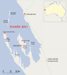
Die Shark Bay mit der Peron-Halbinsel

Die Peron-Halbinsel ist eine langgestreckte Halbinsel, die in der Shark Bay in Western Australia liegt. Sie ist 130 km lang und erstreckt sich in nordwestlicher Richtung vom Henri Freycinet Harbour und westlich zum Hamelin Pool Marine Nature Reserve und Faure Island.

Inhaltsverzeichnis

Lage

Es handelt sich um die größte Halbinsel in der Shark Bay, auf der die Siedlungen Denham und Monkey Mia liegen. Auch ein Lufthafen, der Shark Bay Airport, befindet sich dort. Die Peron-Halbinsel ist das Gebiet der frühen Siedler der Peron- und der Nangastation.

Die Peron-Halbinsel ist ein bedeutender Bestandteil des Weltnaturerbes der Shark Bay. Das nördlich liegende Gebiet der Halbinsel beinhaltet den François Peron National Park, der vom Shark Bay Marine Park umgeben und im hohen, südöstlichen Teil mit dem Hamelin Pool Marine Nature Reserve verbunden ist.

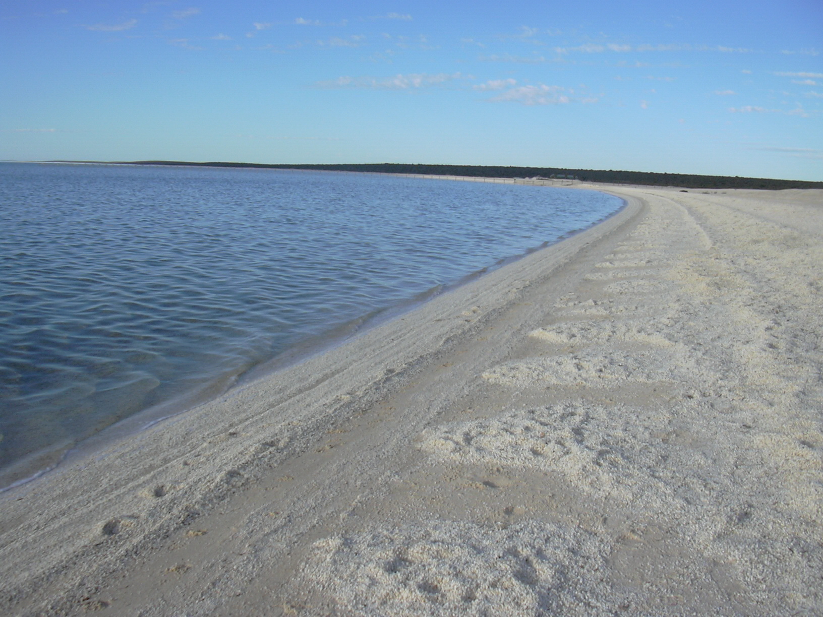
Der Shell-Beach auf der Peron-Halbinsel

Die schmalste Stelle der Halbinsel befindet sich zwischen Nanga und Goulet Bluff; dort liegt der Shell Beach, der auf der östlichen Seite in der L'Haridon Bight liegt.

Der nördlichste Punkt der Halbinsel ist das Cape Peron, das nicht mit dem Cape Peron bei Perth zu verwechseln ist.

Geschichte

Die Halbinsel ist nach dem Naturwissenschaftlier François Péron benannt, der dieses Gebiet mit der Baudin-Expedition in den Jahren 1801 bis 1803 erreichte.[1] Die Halbinsel wurde ab 1880 zur Schafszucht landwirtschaftlich genutzt, bis das Land im Jahr 1990 durch die Regierung aufgekauft wurde.

Peron Homestead Artesian Bore

Die Peron Historical Homestead mit einem Besucherzentrum befindet sich in der Nähe von Denham. Die Peron-Halbinsel ist Teil des Carnarvon-Beckens, einem geologischen Sedimentationsbecken, das mit Frischwasser gefüllt ist. Während der frühen 1900er Jahre wurden Bohrungen durchgeführt, um eine größere und qualitätsvollere Wassermenge zu erhalten. Das gewonnene artesische Wasser war 35-60oC heiß und hatte einen hohen Salz- und Mineralgehalt.

Literatur

  • Edinburgh Journal of Natural and Geographical Science (1830): Account of Peron's Peninsula, in Shark's Bay, Western Australia. S. 249-257
  • Thomson, Carolyn (1997) Discovering Shark Bay Marine Park and Monkey Mia. Como, W.A. Department of Conservation and Land Management. ISBN 0-7309-6854-5

Einzelnachweise

  1. Australia Tourism website. Abgerufen am 10. September 2010
-26.106121113.667297

Wikimedia Foundation.

Игры ⚽ Поможем решить контрольную работу

Schlagen Sie auch in anderen Wörterbüchern nach:

  • Peron Peninsula — is located in the Shark Bay World Heritage site in Western Australia.It is the largest of the Shark Bay peninsulas.It is the location of the localities of Denham and Monkey Mia.It is the location of former Pastoral leases Peron, and Nanga… …   Wikipedia

  • Peron Peninsula — Presqu île Péron La baie Shark avec la péninsule Péron au centre La presqu île Péron est une vaste presqu île australienne s avançant au centre de la baie Shark, un golfe de l océan Indien situé sur la côte ouest de l Australie Occidentale. Elle… …   Wikipédia en Français

  • Peron — may refer to : * Peron Islands, two low laying islands off the west coast of the Northern Territory of Australia * Peron Peninsula, located in the Shark Bay World Heritage site in Western Australia * Peron s Tree Frog * Peron, Western Australia,… …   Wikipedia

  • Francois Peron National Park — Francois Peron is a national park on the Peron Peninsula in Western Australia (Australia), 726 km north of Perth, and located within the boundary of the Shark Bay World Heritage area. Names and earlier usesIt is named after the French naturalist… …   Wikipedia

  • Péninsule Péron — Presqu île Péron La baie Shark avec la péninsule Péron au centre La presqu île Péron est une vaste presqu île australienne s avançant au centre de la baie Shark, un golfe de l océan Indien situé sur la côte ouest de l Australie Occidentale. Elle… …   Wikipédia en Français

  • Presqu'île Péron — 26° 06′ 22″ S 113° 40′ 01″ E / 26.1061, 113.667 …   Wikipédia en Français

  • Shark Bay, Western Australia — Infobox World Heritage Site WHS = Shark Bay, Western Australia State Party = AUS Type = Natural Criteria = vii, viii, ix, x ID = 578 Region = Asia Pacific Year = 1991 Session = 15th Link = http://whc.unesco.org/en/list/578: See also Shark Bay for …   Wikipedia

  • Faure Island — (25º 51 S, 113º 53 E) is a 58 km² is an island pastoral lease and nature reserve, east of the Francois Peron National Park on the Peron Peninsula, in Shark Bay, Western Australia. It lies in line with the Monkey Mia resort to the west, and the… …   Wikipedia

  • Перон (полуостров) — У этого термина существуют и другие значения, см. Перон. Перон (англ. Peron Peninsula) полуостров в Австралии. Содержание 1 География 2 История 3 …   Википедия

  • Shark Bay Marine Park — area = 7,118.63 km² established = 1990 visitation num = visitation year = managing authorities = Department of Environment and Conservation official site = [http://www.naturebase.net/component/option,com hotproperty/task,view/id,53/ Shark Bay… …   Wikipedia

Share the article and excerpts

Direct link
Do a right-click on the link above
and select “Copy Link”