Princess Royal Island

Princess Royal Island
Gewässer Pazifischer Ozean
Geographische Lage 52° 55′ N, 128° 50′ W52.916666666667-128.833333333331061Koordinaten: 52° 55′ N, 128° 50′ W
Lage von Princess Royal Island
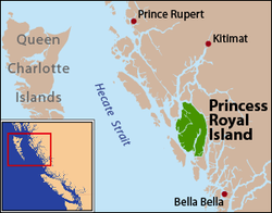
Länge 83,2 km
Breite 45,1 km
Fläche 2.251 km²
Höchste Erhebung Mount Parry
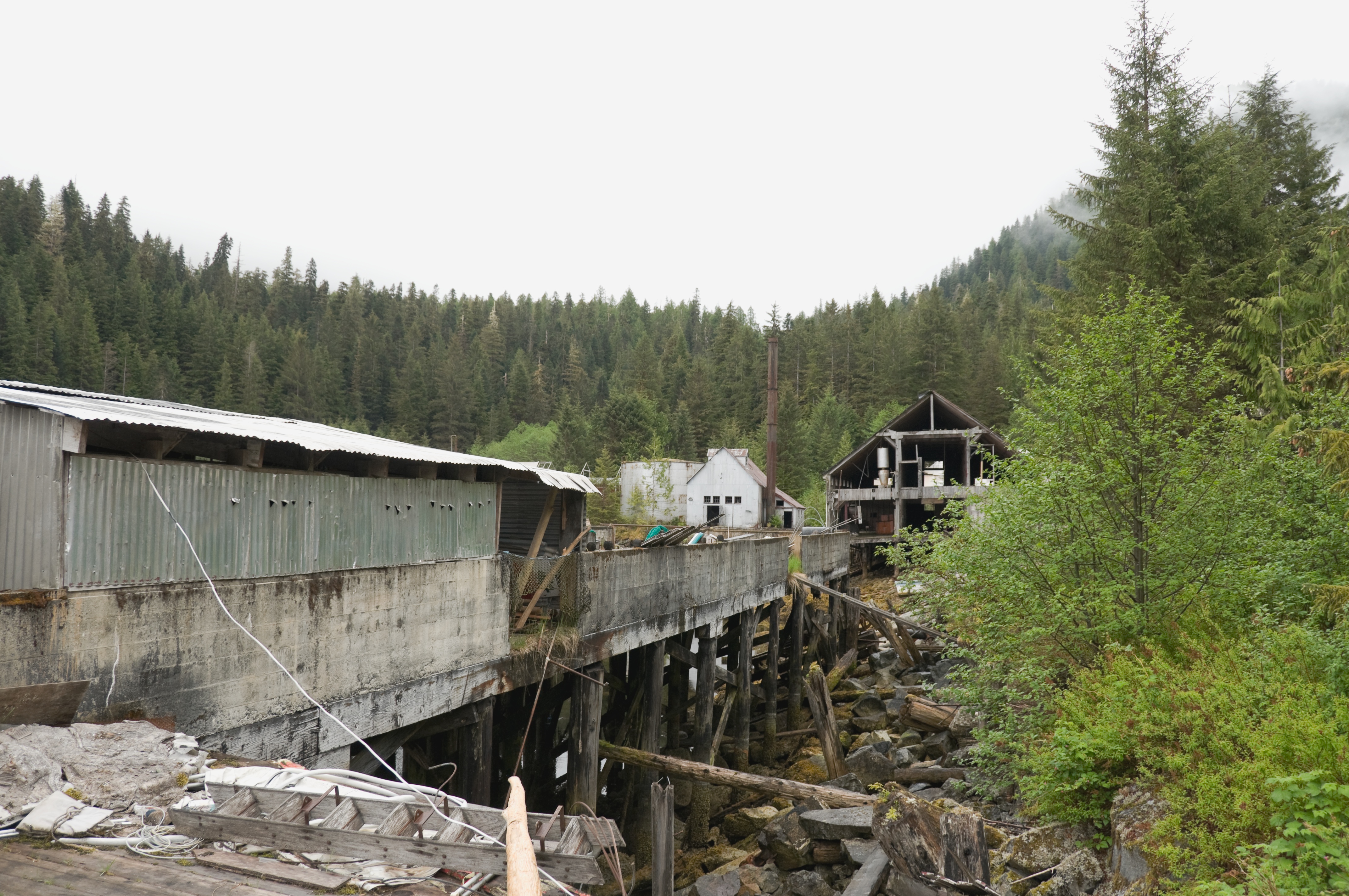
1.061 m
Einwohner (unbewohnt)
Hauptort Butedale (historisch)
Ruinen einer Konservenfabrik

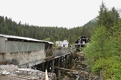
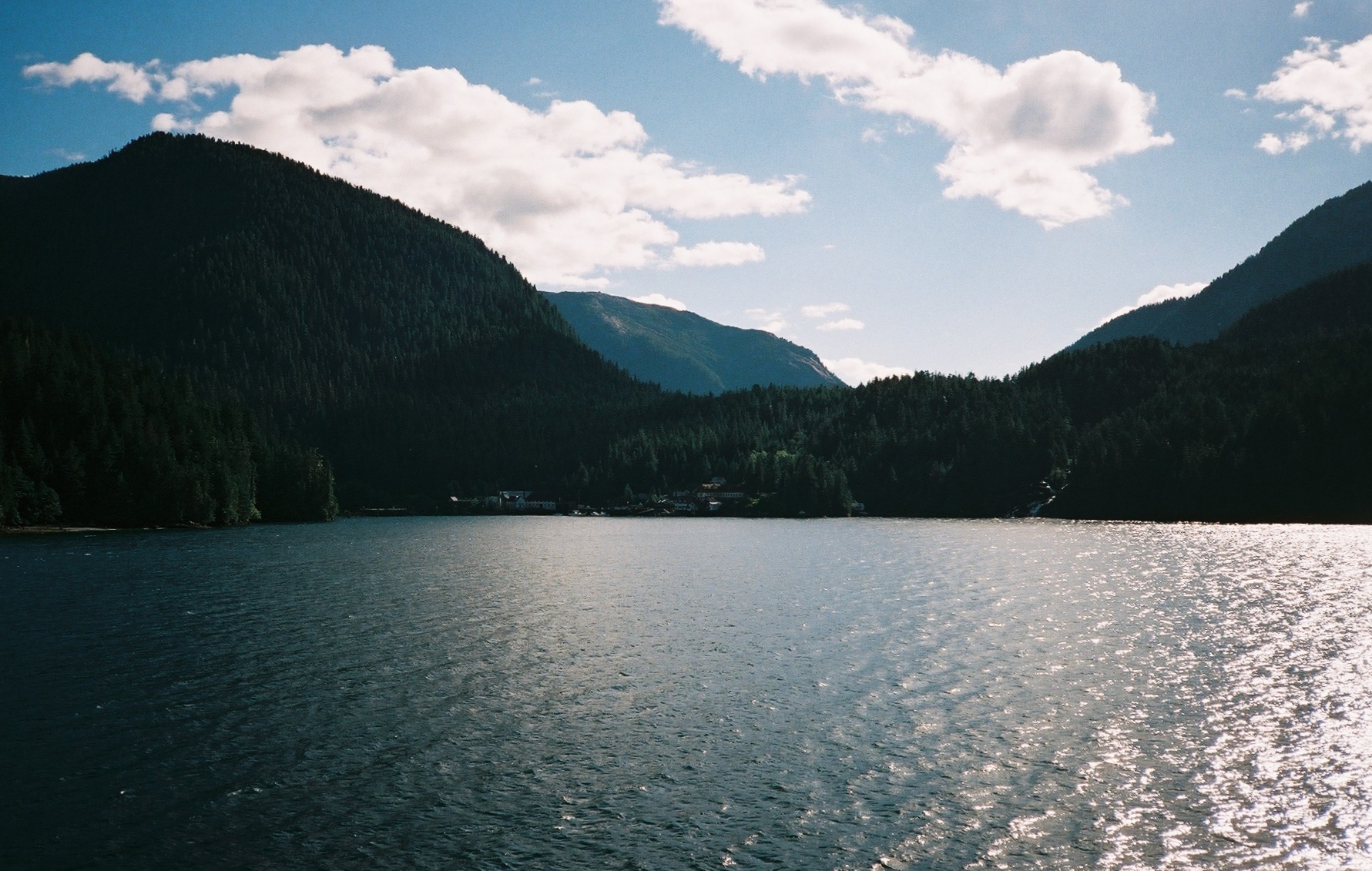
Princess Royal Island ist die viertgrößte Insel in der kanadischen Provinz British Columbia. Die 2.251 km²[1] große, unbewohnte Insel erhielt ihren Namen 1788 durch Kapitain Charles Duncan, der sie nach seiner Sloop Princess Royal benannte. Die Insel liegt an der Inside Passage, 520 km nördlich von Vancouver und 200 km südlich von Prince Rupert.

Man kann Princess Royal Island nur mit dem Boot oder dem Flugzeug erreichen. Heute ist die Insel unbewohnt, früher gab es hier aber kleine Siedlungen von Goldschürfern, Holzfällern und Fischern.

1950 stürzte auf der Insel eine B-36 mit Atombomben an Bord ab. Beim Aufprall der Maschine auf einen Berg bei schlechtem Wetter starben 5 von 17 Besatzungsmitgliedern. Der Unfall gilt als erster Verlust von Kernwaffen überhaupt.

Die Insel ist von gemäßigtem Regenwald bestanden, insbesondere findet sich hier die Westamerikanische Hemlocktanne. Neben Grizzlys, Wölfen, Füchsen, Hirschen, Marmelalken, See-Elefanten und Schwertwalen sind hier seltene Arten wie der Kermodebär und der Steinadler heimisch.

Weblinks

Einzelnachweise

  1. The Atlas of Canada – Pacific Coast Islands (englisch)

Wikimedia Foundation.

Игры ⚽ Нужно решить контрольную?

Schlagen Sie auch in anderen Wörterbüchern nach:

  • Princess Royal Island — Infobox Islands name = Princess Royal image caption = Pricess Royal Island is located on the east side of Hecate Strait image size = locator Location map|Canada British Columbia|lat=52.916667|long= 128.833333 map custom = yes native name = native …   Wikipedia

  • Princess Royal Island — Sp Karãliškosios Princèsės salà Ap Princess Royal Island L Ramiajame vand., Kanada (Britų Kolumbija) …   Pasaulio vietovardžiai. Internetinė duomenų bazė

  • Princess Royal Island (Nunavut) — Infobox Islands name = Princess Royal Island image caption = image size = locator map custom = native name = native name link = Inuktikut nickname = location = Northern Canada coordinates = coord|76|55|59|N|94|19|00|W|display=inline,title… …   Wikipedia

  • Princess Royal (sloop) — Princess Royal was a British merchant ship that sailed on fur trading ventures in the late 1780s, and was captured at Nootka Sound by Esteban José Martínez of Spain during the Nootka Crisis of 1789. Called the Princesa Real while under the… …   Wikipedia

  • Princess Royal Reach — Infobox Ocean Ocean name = Princess Royal Reach, Jervis Inlet image lake = caption lake = image bathymetry = caption bathymetry= location = Jervis Inlet, between Queens Reach and Prince of Wales Reach, New Westminster Land District coords =… …   Wikipedia

  • Princess Louise (sidewheeler) — Princess Louise, at Masset, BC, circa 1880. Career Nam …   Wikipedia

  • Princess Cruises — Rechtsform Limited, Tochter der Carnival Corporation plc Gründung 1965 …   Deutsch Wikipedia

  • Princess Margaret, Countess of Snowdon — Princess Margaret redirects here. For other uses, see Princess Margaret (disambiguation). Countess of Snowdon redirects here. For the title, see Earldom of Snowdon. Princess Margaret Countess of Snowdon Spouse …   Wikipedia

  • Princess Margaret of Connaught — Crown Princess of Sweden; Duchess of Scania Spouse Gustaf Adolf, Crown Prince of Sweden Issue Prince Gustav Adolf, Duke of Västerbotten P …   Wikipedia

  • Princess Sibylla of Saxe-Coburg and Gotha — Princess Sibylla Duchess of Västerbotten Princess Sibylla in the 1930s Spouse Prince Gustav Adolf, Duke of Västerbotten Issue …   Wikipedia

Share the article and excerpts

Direct link
Do a right-click on the link above
and select “Copy Link”