- River Keer
-
Keer 
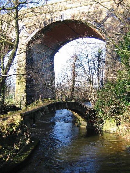
Brücke über den River Keer unter dem Eisenbahnviadukt der Bahnstrecke Carnforth-Skipton
Daten Lage Lancashire, England Flussgebietseinheit North West Ursprung Deer Moor
54° 10′ 13″ N, 167° 0′ 0″ W54.170248-167Mündung in die Morecambe Bay 54.122313-2.801099Koordinaten: 54° 7′ 20″ N, 2° 48′ 4″ W
54° 7′ 20″ N, 2° 48′ 4″ W54.122313-2.801099Gemeinden Carnforth
Der River Keer ist ein Fluss in Lancashire. Er entspringt im Docker Moor und fließt in östlicher Richtung bis zu seiner Mündung in die Morecambe Bay bei Carnforth.Der Fluss ist die südliche Grenze der Arnside and Silverdale Area of Outstanding Natural Beauty.
Kategorien:- Fluss in Europa
- Fluss in England
- Lancashire
Wikimedia Foundation.