- Roncador Reef
-
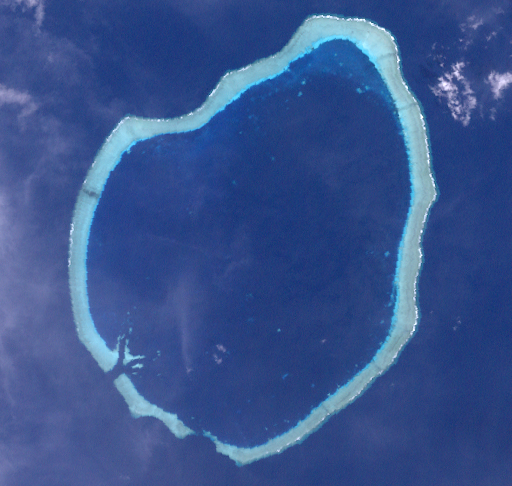
Roncador Reef Landsat-Bild des Riffs
Gewässer Pazifischer Ozean Geographische Lage 6° 13′ S, 159° 22′ O-6.2166666666667159.36666666667Koordinaten: 6° 13′ S, 159° 22′ O 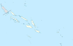

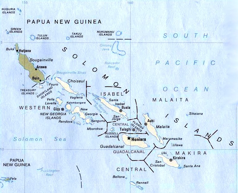
Anzahl der Inseln 0 Länge 14,4 km Breite 10,6 km Landfläche 0 ha Gesamtfläche 120 km² Einwohner (unbewohnt) Die Karte der Salomon-Inseln zeigt das Roncador Reef südlich von Ontong Java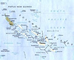
Das Roncador Reef ist ein atollartiges Korallenriff in der Provinz Malaita, Salomonen. Es liegt 75 km südlich des Atolls Ontong Java, der nächstgelegenen Landmasse, und 158 km nördlich der Insel Santa Isabel. Der Riffkranz ist 14,4 km lang und maximal 10,6 km breit, was einer Gesamtfläche von rund 120 km² entspricht. Das ringförmige Riff ist durchschnittlich gut 600 Meter breit, an der engsten Stelle im Süden nur 250 Meter und an der breitesten im Norden etwa 940 Meter.[1]
Die Lagune 27 bis 36 Meter tief. Schiffe können durch zwei etwa 200 Meter breite Öffnungen im Süden des Riffs in die Lagune einfahren und ankern. Auf der Westseite des Riffs ragen mehrere Felsblöcke über Wasser. Dies sind jedoch keine Inseln; das Riff weist keine Inseln auf. Der nördlichste dieser Felsblöcke ragt drei Meter aus dem Wasser, und einer knapp fünf Kilometer südlich davon 1,8 m. Dazwischen fällt das Riff über die gesamte Länge trocken. An der Ostseite des Riffs herrscht starke Brandung.[2][3] Das Riff wird von den Häuptlingen von Ontong Java als Eigentum betrachtet.[4]
Adam Johann von Krusenstern berichtet 1819, Alvaro de Mendaña de Neyra und Francisco Antonio Mourelle hätten unabhängig voneinander im 16. bzw. 18. Jahrhundert das Riff entdeckt, wobei ersterer ihm den Namen Baxo de Candelaria, letzterer den heute gebrauchten (spanisch roncador bedeutet ‚Schnarcher‘) gegeben habe. Krusenstern attestierte dem Riff eine Länge von 45 Meilen von Nordosten nach Südwesten. [5].
Durch die Erzählung The pearl divers of Roncador Reef des australischen Autors George Lewis Becke (1855–1913) wurde das Riff literarisch.[6]
Weblinks
Einzelnachweise
- ↑ Pixelgröße 30 Meter. Das 512 Pixel breite Bild ist 15,36 km breit. Diese Information wurde als Basis für Messungen verwendet.
- ↑ Hydrographer of the Navy, Pacific Islands Pilot Vol 1, Ninth Edition, 1971
- ↑ National Geospatial-Intelligence Agency: Pub. 126, Sailing Directions (enroute), Pacific Islands, 2010, Ninth Edition, 8.3 Roncador Reef, Seite 209
- ↑ Remote Atolls and Offshore Islands of PNG and the Solomons
- ↑ Ivan Fedorovich Kruzenshtern: Beyträge zur Hydrographie der grössern Ozeane als Erläuterungen zu einer Charte des ganzen Erdkreises nach Mercator's Projection, Leipzig (Kummer) 1819, S 209 f. Volltext online
- ↑ George Lewis Becke: The pearl divers of Roncador Reef, London (J. Clarke) 1908, Neuauflage Charleston SC (BiblioBazaar) 2009, ISBN 978-1117389066, Volltext online
Kategorien:- Korallenriff
- Atoll
- Geographie (Salomonen)

Wikimedia Foundation.