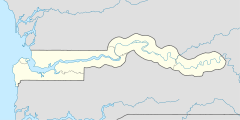
Sami (Central River Region)
Schlagen Sie auch in anderen Wörterbüchern nach:
Central River Region — Karte Lage der Region in Gambia Central River Region … Deutsch Wikipedia
Dobo (Central River Region) — 13.474937930556 14.639607{{{elevation save}}}Koordinaten … Deutsch Wikipedia
Karantaba (Central River Region) — Karantaba 13.569998027222 14.5611573{{{elevation save}}}Koordinaten … Deutsch Wikipedia
Sami (Distrikt) — Sami Lage des Distrikts in der Central River Region … Deutsch Wikipedia
Sami people — For other uses, see Sami (disambiguation). Samis redirects here. For the Samis Foundation, see Sam Israel. Sámi Mari Boine • Lars Levi Læstadius • Lisa Thomasson • … Wikipedia
Sami history — The Sami peoples (originally known as Saami) have inhabited the northern regions of Fenno Scandinavia and Russia for a long time in coexistence with other peoples. The traditional Sami life style, dominated by hunting, fishing and trading, was… … Wikipedia
Liste von Kultplätzen in Gambia — Die Liste von Kultplätzen in Gambia listet Kultstätten oder Kultplätze im westafrikanischen Staat Gambia auf. Die Auflistung wurde vom National Centre for Arts Culture 1998 veröffentlicht. Die Kultstätten sind näher klassifiziert als „heilig“… … Deutsch Wikipedia
Verwaltungsgliederung Gambias — Die Verwaltungsgliederung Gambias bzw. die Administrative Gliederung stellt sich wie folgt dar: Der westafrikanische Staat Gambia ist in fünf Regionen und zwei Gemeinden (englisch municipalities), die Stadt Banjul und die Gemeinde Kanifing,… … Deutsch Wikipedia
Reich Niani — Karte von Senegambia Das Reich Niani war ein historisches Reich auf dem Gebiet der heutigen westafrikanischen Staaten Gambia und Senegal.[1] Niani lag am nördlichen Ufer des Gambia, orografisch auf der rechten Seite. Im Westen wur … Deutsch Wikipedia
Jarumeh Koto — 13.57869633 14.783943716111{{{elevation save}}}Koordinaten: 13 … Deutsch Wikipedia


