- Sanafir
-
Sanafir Karte der Tiran-Straße, mit Sanafir im Osten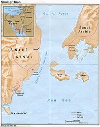
Gewässer Straße von Tiran,
Rotes MeerGeographische Lage 27° 56′ 2″ N, 34° 41′ 56″ O27.93388888888934.69888888888949Koordinaten: 27° 56′ 2″ N, 34° 41′ 56″ O 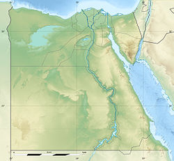

Länge 8,7 km Breite 5,9 km Fläche 33 km² Höchste Erhebung Ra‘s Şināfīr
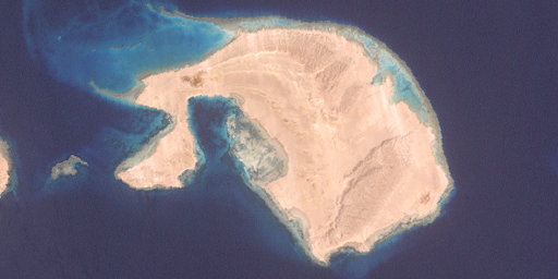
49 mEinwohner (unbewohnt) Satellitenbild von Sanafir
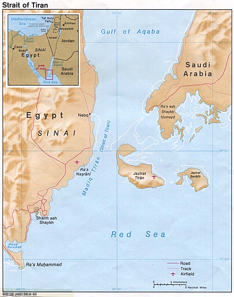
Sanafir (arabisch جزيرة صنافير) ist eine Insel im Golf von Akaba. Sie gehört zusammen mit der westlich benachbarten Insel Tiran zur Provinz Tabuk von Saudi-Arabien, ist jedoch an Ägypten verpachtet.[1]
Inhaltsverzeichnis
Geographie
Die Insel ist Teil der Straße von Tiran. Heute gehört die etwa 33 km² große Insel ebenso wie Tiran zum Ras Muhammad National Park. Die Insel ist etwa neun Kilometer vom Saudi-Arabischen Festland (Ra's al Qaşbah ) entfernt, und von Ägypten (Sinai-Halbinsel) knapp 23 km. Die Nachbarinsel Tiran liegt 2.8 km westlich von Sanafir, von dieser getrennt durch die Meeresstraße Ḩalq al Qarūsh. Zwischen den beiden Inselm liegt das Riff Sha‘b Abū Tinūn.
Im Osten der Insel erheben sich zahlreiche zerklüftete Kalksteinhügel, der höchste jedoch, der 49 Meter hohe Ra‘s Şināfīr, liegt nahe dem südwestlichen Ende der Insel.
Geschichte
Israel besetzte das Eiland während der Sueskrise und von 1967 bis 1982 infolge des Sechstagekriegs.
Referenzen
Weblinks
- Beschreibung Tirans auf Globalsecurity.org (englisch)
Kategorien:- Unbewohnte Insel
- Insel (Saudi-Arabien)
- Insel (Rotes Meer)
- Insel (Asien)
Wikimedia Foundation.