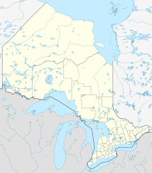
Sandy Lake (Severn River)
Schlagen Sie auch in anderen Wörterbüchern nach:
Sandy Lake — bezeichnet mehrere First Nations Sandy Lake First Nation, unabhängige Oji Cree First Nation in Ontario Sandy Lake bezeichnet mehrere Seen in Kanada Sandy Lake (Manitoba) Sandy Lake (Nova Scotia) Sandy Lake (Severn River), in Kenora District,… … Deutsch Wikipedia
Severn River (Hudson Bay) — Severn RiverVorlage:Infobox Fluss/GKZ fehlt Lage Ontario (Kanada) Flusssystem Severn River Abfluss über Severn River → Hudson Bay … Deutsch Wikipedia
Severn River (northern Ontario) — The Severn River is a river in northern Ontario. The northern Ontario river has its headwaters near the western border of the province. From the head of the Black Birch River, the Severn River is 982 km (610 mile) long and its drainage basin is… … Wikipedia
river — river1 riverless, adj. riverlike, adj. /riv euhr/, n. 1. a natural stream of water of fairly large size flowing in a definite course or channel or series of diverging and converging channels. 2. a similar stream of something other than water: a… … Universalium
Lake Michigan — Landsat … Wikipedia
Lake Ontario — For the putative lake on Titan, see Ontario Lacus Lake Ontario The lake seen from Dutch Street Road, Huron, New York … Wikipedia
River Thames — Thames redirects here. For other uses, see Thames (disambiguation). Coordinates: 51°29′56″N 0°36′31″E / 51.4989°N 0.6087°E / 5 … Wikipedia
Deer Lake First Nation — is an Oji Cree First Nation in Northern Ontario, located north of Red Lake, Ontario. It is one of the few First Nations in Ontario to have signed Treaty 5. It is part of the Keewaytinook Okimakanak Council (Northern Chiefs) and the Nishnawbe Aski … Wikipedia
Northwest Branch Anacostia River — Coordinates: 38°56′34″N 76°56′39″W / 38.942832°N 76.944036°W / 38.942832; 76.944036 … Wikipedia
North Spirit Lake First Nation — is a small Oji Cree community in Northern Ontario, located north of Red Lake, Ontario. It is connected to Sandy Lake First Nation, and Deer Lake First Nation by winter/ice roads. It is part of the Keewaytinook Okimakanak Council (Northern Chiefs) … Wikipedia

