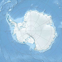
Shoemaker Peak — (coord|79|51|S|82|19|W|) is a peak on the east side of Ahrnsbrak Glacier, 3 miles (4.8 km) east southeast of Sutton Peak in the Enterprise Hills, Heritage Range. Mapped by United States Geological Survey (USGS) from surveys and U.S. Navy air… … Wikipedia
Comet Shoemaker-Levy 9 — Shoemaker Levy redirects here. For other Shoemaker Levy comets see List of periodic comets. Infobox Comet name=SL9 (Shoemaker Levy) caption=Image of Comet Shoemaker Levy 9 fragments (total: 21), taken on May 17, 1994 discoverer= Carolyn Shoemaker … Wikipedia
Comet Shoemaker–Levy 9 — D/1993 F2 (Shoemaker–Levy) Image of Comet Shoemaker–Levy 9 fragments (total: 21), taken on May 17, 1994 Discovery Discovered by: Carolyn Shoemaker Eugene M. Shoemaker David Levy Discovery date … Wikipedia
Enterprise Hills — p1f1p4 Enterprise Hills Höchster Gipfel Linder Peak (2.010 m) Teil der Heritage Range … Deutsch Wikipedia
Ahrnsbrak Glacier — (coord|79|48|S|82|18|W|type:glacier region:AQ|display=inline,title) is a glacier in the Enterprise Hills of the Heritage Range, flowing north between Sutton Peak and Shoemaker Peak to the confluent ice at the lower end of Union Glacier. Mapped by … Wikipedia
Ahrnsbrak-Gletscher — 79.8 82.316666666667 Koordinaten: 79° 48′ 0″ S, 82° 19′ 0″ W … Deutsch Wikipedia
Bell Valley (Antarktis) — 79.85 82 Koordinaten: 79° 51′ 0″ S, 82° 0′ 0″ W … Deutsch Wikipedia
Impact crater — The prominent impact crater Tycho on the Moon. In the broadest sense, the term impact crater can be applied to any depression, natural or manmade, resulting from the high velocity impact of a projectile with a larger body. In most common usage,… … Wikipedia
Gary SNYDER — Pour les articles homonymes, voir Snyder. Gary Sherman Snyder est un poète, traducteur, penseur et activiste américain né le 8 mai 1930 à San Francisco. Il est une figure importante au sein des mouvements de la Beat Generation, des… … Wikipédia en Français
Gary Snyder — Pour les articles homonymes, voir Snyder. Gary Sherman Snyder est un poète, traducteur, penseur et militant américain né le 8 mai 1930 à San Francisco. C est une figure importante au sein des mouvements de la Beat Generation, des… … Wikipédia en Français

