Skidegate Channel

Skidegate Channel
Skidegate Channel
Verbindet Gewässer Hecate Strait
mit Gewässer Pazifischer Ozean
Trennt Landmasse Graham Island
von Landmasse Moresby Island
Daten

Geographische Lage

53° 9′ N, 132° 20′ W53.15-132.33333333333Koordinaten: 53° 9′ N, 132° 20′ W
Skidegate Channel (British Columbia)
Skidegate Channel
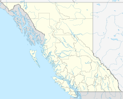
Länge 50 km
Geringste Breite 25 m
Küstenorte Skidegate, Alliford Bay

Der Skidegate Channel (deutsch „Skidegate-Kanal“) ist eine rund 50 km lange Meerenge im kanadischen Archipel Haida Gwaii vor der Westküste British Columbias. Sie trennt die beiden Hauptinseln des Archipels, Graham Island im Norden und Moresby Island im Süden und verbindet die Hecate Strait im Osten mit dem Pazifischen Ozean im Westen. An der schmalsten Stelle (bei 53° 9′ 7″ N, 132° 17′ 0″ W53.151877777778-132.28336111111) hat der Skidegate Channel eine Breite von nur etwa 25 Metern.

Benannt ist die Meerenge nach der Haida-Gemeinde Skidegate an der Südostküste von Graham Island. Zwischen Skidegate und Alliford Bay auf Moresby Island quert eine Fährverbindung den Skidegate Channel.

Weblinks


Wikimedia Foundation.

Игры ⚽ Поможем сделать НИР

Schlagen Sie auch in anderen Wörterbüchern nach:

  • Skidegate Channel — is a strait in the Queen Charlotte Islands of the North Coast of British Columbia, Canada. It divides the archipelago s two main islands, Graham Island to the north and Moresby Island to the south. External links*BCGNIS|31130|Skidegate Channel …   Wikipedia

  • Graham Island (Queen Charlotte Islands) — Vorlage:Infobox Insel/Wartung/Höhe fehlt Graham Island Karte der Queen Charlotte Islands, Graham Island ist die nördliche Hauptinsel Gewässer …   Deutsch Wikipedia

  • Graham Island (Haida Gwaii) — Vorlage:Infobox Insel/Wartung/Höhe fehlt Graham Island Karte des Archipels Haida Gwaii, Graham Island ist die nördliche Hauptinsel …   Deutsch Wikipedia

  • Liste von Meeresstraßen — Dies ist eine Liste von Meeresstraßen (Meerengen) in tabellarischer Form: Name der Meeresstraße verbindet ... mit ... liegt zwischen ... und ... Alsensund Apenrader Förde Flensburger Förde Alsen Sundewitt Anegada Passage Karibisches Meer… …   Deutsch Wikipedia

  • Isla Graham (Canadá) — Isla Graham Graham Island Haida Gwaii Localización País …   Wikipedia Español

  • Moresby Island — Karte des Archipels Haida Gwaii, Moresby Island im Süden Gewässer Pazifischer Ozean …   Deutsch Wikipedia

  • BC Ferries — Infobox Company company name = British Columbia Ferry Services Inc. company company type = Organized as a privately held company, with the provincial Crown as sole shareholder foundation = Victoria, British Columbia (1960) location = Victoria,… …   Wikipedia

  • Maritime Fur Trade — The North West Coast during the Maritime Fur Trade era, about 1790 to 1840 The Maritime Fur Trade was a ship based fur trade system that focused on acquiring furs of sea otters and other animals from the indigenous peoples of the Pacific… …   Wikipedia

  • Native countries of North America — The following is a list of names of Native countries of North America the homelands of American Indian and Inuitic peoples. Autonymic names in Native American languages are in bold, translations of the Native names are in parentheses and quotes.… …   Wikipedia

  • Graham Island — See also Graham Island (disambiguation). Infobox Islands name = Graham image caption = Graham Island is the large northern island image size = locator Location map|Canada British Columbia|lat=53.442264|long= 132.242432 map custom = yes native… …   Wikipedia

Share the article and excerpts

Direct link
Do a right-click on the link above
and select “Copy Link”