Springer Peak

Springer Peak
Springer Peak

Photo-request.svg

Bild gesucht 

BWf1

Höhe 1.460 m
Lage Antarktis
Gebirge Webers Peaks, Ellsworthgebirge
Geographische Lage 79° 24′ 0″ S, 84° 53′ 0″ W-79.4-84.8833333333331460Koordinaten: 79° 24′ 0″ S, 84° 53′ 0″ W
Springer Peak (Antarktis)
Springer Peak

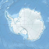
Springer Peak ist ein 1.460 m hoher Felsgipfel, der am nördlichen Ende der Webers Peaks in der westantarktischen Heritage Range aufragt.[1]

Springer Peak wurde vom United States Geological Survey im Rahmen der Erfassung des Ellsworthgebirges in den Jahren 1961–66 durch Vermessungen vor Ort und Luftaufnahmen der United States Navy kartografiert. Das Advisory Committee on Antarctic Names benannte ihn nach Michael J. Springer, der als Fotograf auf Flügen der United States Navy in den Sommermonaten 1965/66 über dem Marie-Byrd-Land und dem Ellsworthland Aufnahmen machte.[1]

Literatur

Einzelnachweise

  1. a b Springer Peak (Englisch). Geographic Names Information System. United States Geological Survey. Abgerufen am 11. Juni 2010.

Wikimedia Foundation.

Игры ⚽ Поможем решить контрольную работу

Schlagen Sie auch in anderen Wörterbüchern nach:

  • Peak oil — A logistic distribution shaped production curve, as originally suggested by M. King Hubbert in 1956 …   Wikipedia

  • Springer Mountain — Infobox Mountain Name = Springer Mountain Photo = Caption = Elevation = convert|3780|ft|m|0 Location = Georgia, USA Range = Blue Ridge Mountains Prominence = Coordinates = coord|34|37|36|N|84|11|37|W|type:mountain region:US… …   Wikipedia

  • Bingham Peak (Antarktis) — Bingham Peak Bild gesucht  BWf1 Höhe 1.540  …   Deutsch Wikipedia

  • The Jerry Springer Show — The logo of The Jerry Springer Show, in use since the show s tenth season starting autumn 2000 Genre Tabloid talk show Directed by Adam Simons Sorota …   Wikipedia

  • Widow's peak — Spitzer Haaransatz bei einem 17jährigen Mädchen Spitzer Haaransatz beim Mann …   Deutsch Wikipedia

  • Webers Peaks — 79.466666666667 84.666666666667 Koordinaten: 79° 28′ S, 84° 40′ W …   Deutsch Wikipedia

  • Balish-Gletscher — 79.416666666667 84.5 Koordinaten: 79° 25′ 0″ S, 84° 30′ 0″ W …   Deutsch Wikipedia

  • Voltage doubler — A voltage doubler is an electronic circuit which charges capacitors from the input voltage and switches these charges in such a way that, in the ideal case, exactly twice the voltage is produced at the output as at its input. The simplest of… …   Wikipedia

  • Temperature — This article is about the thermodynamic property. For other uses, see Temperature (disambiguation). A map of global long term monthly average surface air temperatures i …   Wikipedia

  • Appalachian Trail — This article is about the trail. For the conservation group, see Appalachian Trail Conservancy. For the train station, see Appalachian Trail (Metro North station). Appalachian Trail Map of Appalachian Trail Length …   Wikipedia

Share the article and excerpts

Direct link
Do a right-click on the link above
and select “Copy Link”