Stewart (British Columbia)

Stewart (British Columbia)
Stewart
Lage in British Columbia
Stewart (British Columbia)
Stewart
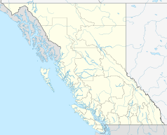
Stewart
Staat: Kanada
Provinz: British Columbia
Regionaldistrikt: Kitimat-Stikine
Koordinaten: 55° 56′ N, 129° 59′ W55.94121-129.98621Koordinaten: 55° 56′ N, 129° 59′ W
Fläche: 571,5 km²
Einwohner: 496 (Stand: 2006)
Bevölkerungsdichte: 0,9 Einw./km²
Zeitzone: Pacific Time (UTC−8)
Postleitzahl: V0T

Stewart ist eine Kleinstadt am Ende des Portland Canal im Bezirk Kitimat-Stikine im Westen der kanadischen Provinz British Columbia.

Inhaltsverzeichnis

Geschichte

Die im Gebiet des Nass River siedelnden Nisga'a bezeichneten die Ebenen rund um die Mündung des Bear River in den Pazifik als Skam a Kounst - Sicherer Platz, da er sie vor den Angriffen der Haida, welche die übrigen Küstenregionen beherrschten, schützte. Das Gebiet am östlichen Ende des Portland Channel war ein bedeutender saisonaler Siedlungsplatz, der besonders im Frühherbst für das Sammeln von Beeren, das Fischen nach Lachs und die Jagd aufgesucht wurde.

Erst 1896 unternahm Hauptmann David du Bose Gaillard (1859–1913) vom United States Army Corps of Engineers eine Forschungsreise, um die Gebiete im extremen Süden Alaskas zu erforschen. Die bald darauf einsetzende genauere Erforschung des Gebietes führte zur Entdeckung von Gold- und Silbervorkommen im Tal des Salmon River im Jahr 1898. Die Gebrüder Stewart siedelten seit 1902 in der Gegend und nach der 1905 erfolgten Eröffnung eines Postamts benannte der Postvorsteher Robert M. Stewart die noch namenlose Siedlung nach sich.

Die Minenindustrie ließ die Bevölkerung bis zur Zeit des Ersten Weltkrieges auf rund 10.000 Menschen anwachsen. Da nur wenig Platz für den Bau von Häusern zur Verfügung stand, wurden Pfahlbauten im Watt und im Meer errichtet, deren Überreste heute noch sichtbar sind. Da die Minen sich als wenig ergiebig erwiesen, nahm die Einwohnerzahl bis zum Ende der zwanziger Jahre bis auf etwa 500 ab. Erst die Eröffnung der Granduc-Kupfermine im Jahr 1956 führte zu einem Anstieg der Bevölkerung auf etwa 2.000; allerdings geht dieser Wert seit der Minenschließung im Jahr 1984 kontinuierlich zurück, so dass die Bevölkerungszählung im Jahr 2006 eine Einwohnerzahl von 496 ergab.

Wirtschaft

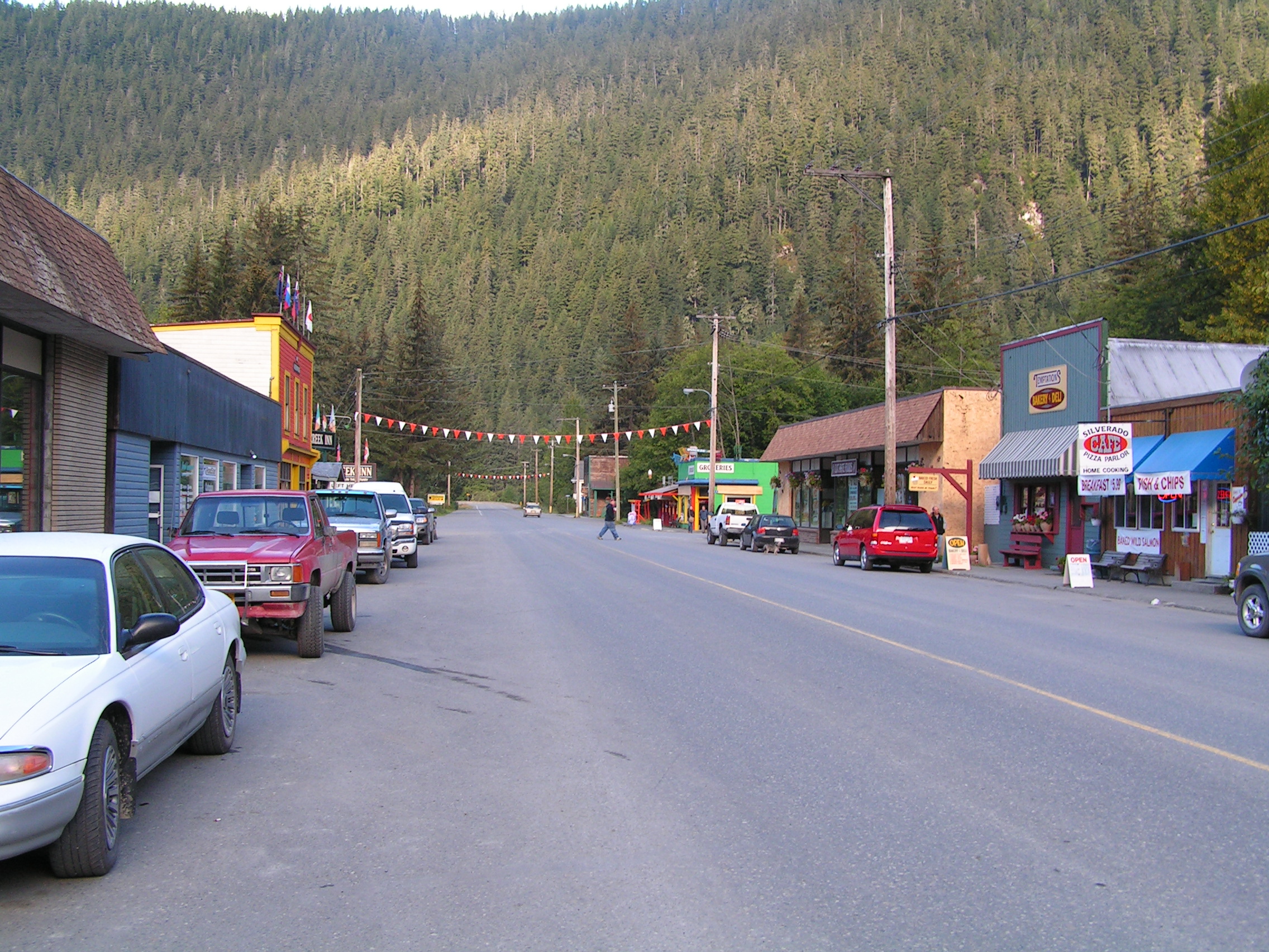
Hauptstraße von Stewart

Der nur noch regional bedeutende Hafen ist der nördlichste, ganzjährig eisfreie Pazifikhafen Kanadas, der Ausbau des Highway 37, dessen Abzweig bei Meziadin Junction als Highway 37A über Stewart bis zur Grenze bei Hyder führt, lässt dessen Bedeutung aber zugunsten von Prince Rupert schwinden. Somit sind kleinere bergbauliche Unternehmen, die Holzwirtschaft und die Fischereiindustrie neben dem Tourismus die Haupterwerbsquellen.

Literatur

  • Ian McLeod und Holly NcNeil: Prospectors, Promoters and Hard Rock Miners. Tales of the Stewart, B. C. and Hyer, Alaska Camps, Kelowna 2004

Weblink


Wikimedia Foundation.

Игры ⚽ Нужно сделать НИР?

Schlagen Sie auch in anderen Wörterbüchern nach:

  • Stewart, British Columbia — Stewart is a small town at the head of the Portland Canal in western British Columbia, Canada. In 2006, its population was about 496. History (see Alaska boundary dispute)The Nisga a, who lived around the Nass River, called the head of Portland… …   Wikipedia

  • British Columbia Coast — Howe Sound, along British Columbia s South Coast. The British Columbia Coast or BC Coast is Canada s western continental coastline on the Pacific Ocean. The usage is synonymous with the term West Coast of Canada. In a sense excluding the urban… …   Wikipedia

  • Stewart Airport (British Columbia) — Infobox Airport name = Stewart Airport IATA = ZST ICAO = CZST type = Public owner = operator = District of Stewart city served = location = Stewart, British Columbia elevation f = 24 elevation m = 7 coordinates = coord|55|56|00|N|129|59|00|W|type …   Wikipedia

  • British Columbia general election, 2001 — 1996 ← May 16, 2001 → 2005 …   Wikipedia

  • Anyox, British Columbia — Anyox was a small company owned mining town in British Columbia, Canada. [BCGNIS|36025|Anyox] Today it is largely destroyed and abandoned. It is located about 60 kilometers (37 miles)southwest of Stewart, British Columbia on the shores of… …   Wikipedia

  • British Columbia Youth Parliament — The British Columbia Youth Parliament (BCYP) is a youth service organization that operates in the guise of a parliament in the Canadian province of British Columbia. The BCYP fulfills its motto of Youth Serving Youth by means of legislation… …   Wikipedia

  • British Columbia Treaty Process — The British Columbia Treaty Process (BCTP) is a land claims negotiation process started in 1993 for outstanding issues with British Columbia s First Nations. Currently, three treaties have been negotiated under the current process. The Nisga a… …   Wikipedia

  • British Columbia Highway 37 — Infobox road province=BC type=BC route=37 maint= length km= length round= length ref= established= direction a= starting terminus= junction= direction b= ending terminus= counties= cities= previous type=Hwy previous route=35 next type=Hwy next… …   Wikipedia

  • British Columbia municipal elections, 2005 — The Canadian province of British Columbia held its triannual municipal elections on November 19, 2005. Voters in each of BC s 157 municipalities elected mayors and councillors, and rural voters elected directors for their regional district… …   Wikipedia

  • British Columbia general election, 1916 — The British Columbia general election of 1916 was the fourteenth general election for the Province of British Columbia, Canada. It was held to elect members of the Legislative Assembly of British Columbia. The election was called on July 5 1916,… …   Wikipedia

Share the article and excerpts

Direct link
Do a right-click on the link above
and select “Copy Link”