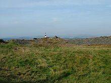
Tap o’ Noth

Tap o’ Noth
Tap o’ Noth
Auf dem Hill o’ Noth

Tap o’ Noth ist eine Hillfort auf dem Hill of Noth, westlich von Rhynie in Aberdeenshire in Schottland.

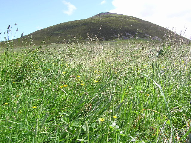
Auf der Spitze des 563 Meter hohen Hügels gelegen, ist dieses Fort nicht nur eines der höchsten, sondern auch eines der ältesten in Schottland. Es besteht aus zwei Mauerringen, einer Außenmauer, die ungefähr 21 Hektar einschließt, und einer massiven inneren Mauer, die auf der Kuppe des Hügels eine rechteckige Zitadelle von 105 Meter × 40 Meter bildet. Die innere Wand wurde mit einem Gerüst aus Holzfachwerk gebaut, das durch einen Brand vernichtet wurde. Die wissenschaftliche Datierung der geschmolzenen Steine weist darauf hin, dass das Feuer am Anfang des 2. Jahrtausends v. Chr. die Bauwerke zerstörte.

Die Ausgrabung Ende des 19. Jahrhunderts offenbarte eine acht Meter breite Mauer, die bis zu einer Höhe von 3,5 Meter erhalten blieb. Innerhalb der äußeren Umwallung liegen mehr als 100 Hausgrundrisse. Am Südende der Zitadelle lag eine große Zisterne. Trotz seiner Lage war dieses Fort zu einer Zeit, als das Klima warm und trocken war, das Domizil einer großen Stammesgruppe.

Literatur

  • Graham Ritchie, Anna Ritchie: Scotland. Archaeology and Early History. 2. paperback edition. Edinburgh University Press, Edinburgh 1992, ISBN 0-748-60291-7, S. 149.
57.333333-2.85

Wikimedia Foundation.

Игры ⚽ Нужен реферат?

Schlagen Sie auch in anderen Wörterbüchern nach:

  • Tap o' Noth — The Tap o Noth is a hill fort on top of the Hill of Noth, 20 miles west of Inverurie in Aberdeenshire, Scotland at grid reference NJ485293. It is the second highest fort in Scotland and its main feature is its well preserved vitrified wall which… …   Wikipedia

  • Tap O' Noth — La ciudad de Rhynie y al fondo la colina de Tap O Noth. Tap O Noth es un castro situado en la localidad escocesa de Rhynie en el condado de Aberdeenshire a unos 22 kilómetros al noroeste de Alford. Es el segundo castro situado a mayor altitud de… …   Wikipedia Español

  • Aberdeenshire (historic) — County of Aberdeen Aberdeenshire within Scotland in 1890 Geography Status County (until 1975) …   Wikipedia

  • Aberdeenshire — Siorrachd Obar Dheathain Verwaltungssitz Aberdeen Fläche 6.313 km² …   Deutsch Wikipedia

  • GB-ABD — Aberdeenshire Siorrachd Obar Dheathain Verwaltungssitz Aberdeen Fläche 6.313 km² (4.) …   Deutsch Wikipedia

  • Rhynie — Saltar a navegación, búsqueda Iglesia de Rhynie, al fondo el castro de Tap O Noth. Rhynie es una localidad escocesa perteneciente al condado de Aberdeenshire a unos 22 kilómetros al noroeste de Alford. Esta antigua ciudad, conocida durante la… …   Wikipedia Español

  • Vitrified fort — is the name given to certain crude stone enclosures whose walls have been subjected in a greater or less degree to the action of fire [cite web |url=http://www.brigantesnation.com/VitrifiedForts/VitrifieedForts.htm |title=Vitrification of Hill… …   Wikipedia

  • List of community council areas in Scotland — This is a list of community council areas established in each of the council areas of Scotland.Aberdeen CityThere are 31 community council areas in the council area. Those marked with an asterisk have a community council. [… …   Wikipedia

  • List of hill forts in Scotland — This List of hill forts in Scotland is a page for any hill fort in Scotland, UK.Aberdeenshire* Bennachie * Tap o NothArgyll Bute* DunaddBorders* Edin s Hall Broch * Eildon hill fort (redirected to:) Trimontium (Newstead)East Lothian* Black Castle …   Wikipedia

  • Dunnideer — (ursprünglich Dun Nideer) ist ein so genanntes Hillfort auf einem 268 m hohen kegelförmigen Hügel westlich von Insch, in der schottischen Grafschaft Aberdeenshire. Die in zwei Phasen errichtete Anlage wird von fünf einigermaßen… …   Deutsch Wikipedia

Share the article and excerpts

Direct link
Do a right-click on the link above
and select “Copy Link”