- Tougues
-
Tougues Wappen Karte 
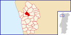
Basisdaten Region: Norte Unterregion: Grande Porto Distrikt: Porto Concelho: Vila do Conde Koordinaten: 41° 22′ N, 8° 42′ W41.359986-8.70013Koordinaten: 41° 22′ N, 8° 42′ W Einwohner: 788 (Stand: 2001) Fläche: 3,3 km² Bevölkerungsdichte: 239 Einwohner pro km² Politik Adresse der Gemeindeverwaltung: Junta de Freguesia de Tougues
Rua das Cortinhas da Fonte, 227
4480-480 TouguesTougues ist eine Gemeinde im Nordwesten Portugals.
Tougues gehört zum Kreis Vila do Conde im Distrikt Porto, besitzt eine Fläche von 3,3 km² und hat 788 Einwohner (Stand: 2001).[1]
Einzelnachweise
- ↑ Daten zu Tougues. alea.pt, abgerufen am 8. Juni 2011 (englisch).
Weblinks
- Karte der Freguesia Tougues beim Instituto Geográfico do Exército
- Information zu Tougues. cm-viladoconde.pt, abgerufen am 8. Juni 2011 (portugiesisch).
 Freguesias im Concelho Vila do Condo
Arcos | Árvore | Aveleda | Azurara | Bagunte | Canidelo | Fajozes | Ferreiró | Fornelo | Gião | Guilhabreu | Junqueira | Labruge | Macieira da Maia | Malta | Mindelo | Modivas | Mosteiró | Outeiro Maior | Parada | Retorta | Rio Mau | Tougues | Touguinha | Touguinhó | Vairão | Vila Chã | Vila do Conde | Vilar | Vilar do Pinheiro
Wikimedia Foundation.
Schlagen Sie auch in anderen Wörterbüchern nach:
Tougues — Freguesia de Portugal … Wikipedia Español
Port de Tougues — Présentation Propriétaire État Protection Classé MH (1997) Géographie … Wikipédia en Français
Liste des monuments historiques de la Haute-Savoie — Cet article recense les monuments historiques de la Haute Savoie, en France. Sommaire 1 Généralités 2 Liste 3 Annexes 3.1 Liens internes … Wikipédia en Français
Районы округа Порту — … Википедия
Тогеш — Посёлок Тогеш Tougues Герб … Википедия
Vila do Conde — (pron. IPA2| vilɐ du kõd(ɨ)) is a city and parish in Portugal with a population of 25,731. Together with the urban parishes of Azurara and Arvore the urban area of the city has 32,094 in the estuary of the Ave river, in the north of Oporto… … Wikipedia
List of postal codes in Portugal — Aveiro districtMealhada municipality*3050 Antes *3050 Barcouço *3050 Casal Comba *3050 Luso *3050 Mealhada *3050 Pampilhosa *3050 Vacariça *3050 Ventosa do BairroMurtosa municipality*3870 Bunheiro *3870 Monte *3870 Murtosa *3870 TorreiraOliveira… … Wikipedia
Holy Jesus Hospital — The Holy Jesus Hospital is a museum and tourist attraction in Newcastle upon Tyne, England in the care of the National Trust.The site of the building has had a 700 year history of helping the townspeople and this history is explained by the… … Wikipedia
Chens-sur-Léman — Chens sur Léman … Deutsch Wikipedia
Fornelo — Wappen Karte … Deutsch Wikipedia
Tougues

18+
© Academic, 2000-2024
- Kontaktieren Sie uns: Unterstützung, Werbung
Wörterbücher Export, schritte mit PHP, Joomla, Drupal, WordPress, MODx.